NASA’s Curiosity rover has detected a mineral mapped from orbit during her first drill campaign at the foothills of the Martian mountain that was key to the science team’s selection of Gale Crater as the rover’s targeted landing site.
This discovery of the mineral hematite marks the first time that Curiosity has identified a mineral on the Red Planets’ surface (first identified via spectral mapping from one of NASA’s Mars orbiters circling overhead).
“This connects us with the mineral identifications from orbit, which can now help guide our investigations as we climb the slope and test hypotheses derived from the orbital mapping,” said Curiosity Project Scientist John Grotzinger, of the California Institute of Technology in Pasadena.
Curiosity has thus ground truthed a significant science discovery made from orbit.
As of today, Nov. 6, the NASA rover has spent 800 Sols, or Martian Days, exploring the Red Planet.
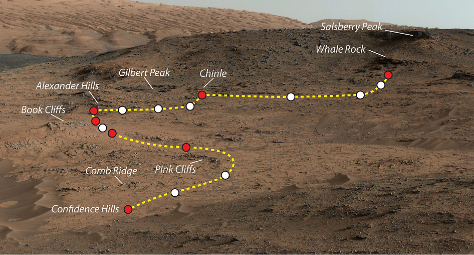
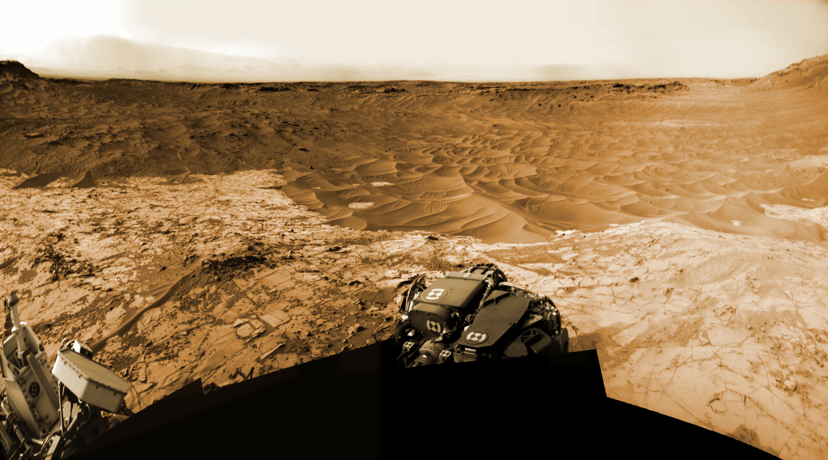
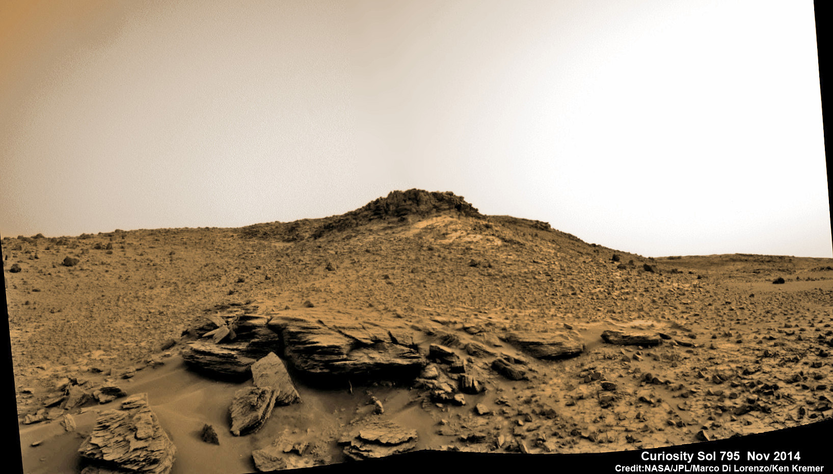
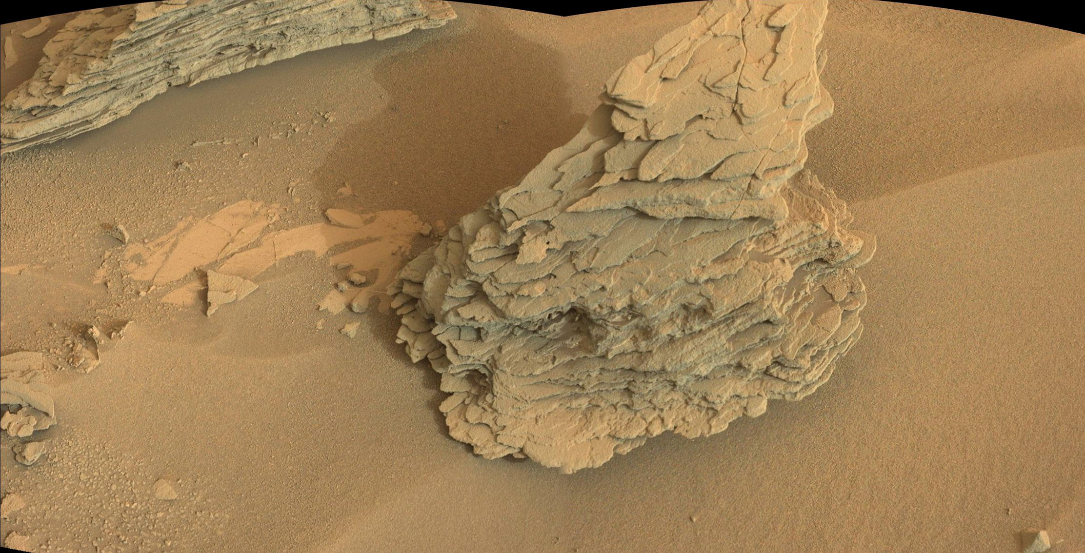
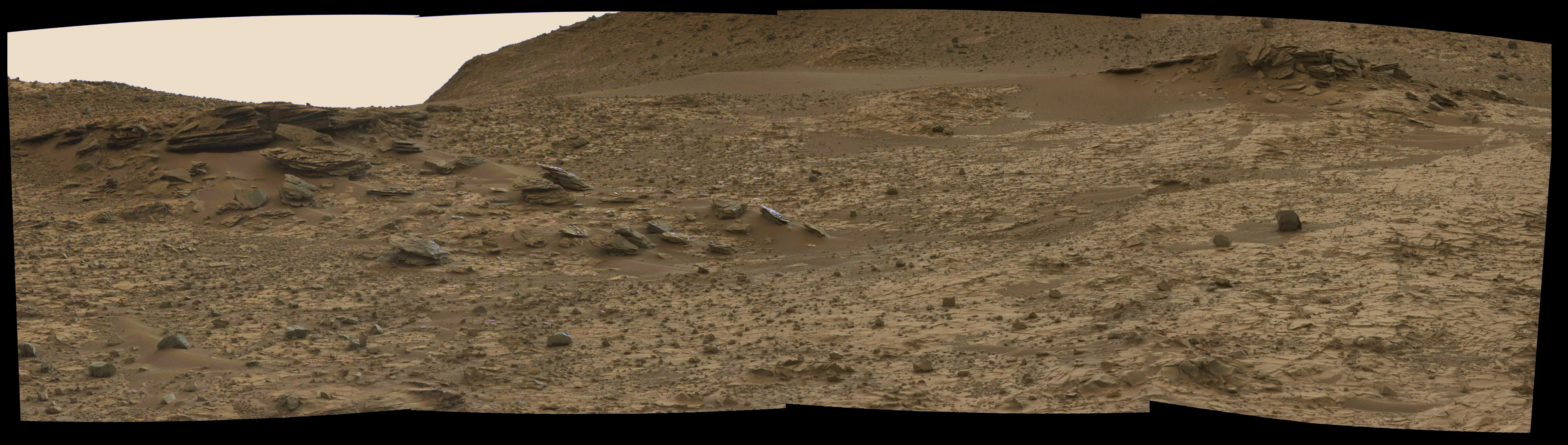
The discovery was made during a “walkabout” while exploring a beautiful area of layered outcrops at Pahrump Hills, shown in photo mosaics above and below by Marco Di Lorenzo and Ken Kremer.
This mineral discovery will greatly aid the rover team by giving them renewed confidence in efficiently directing the six-wheeled robot to the most scientifically bountiful spots to explore for the remainder of the mission. It will also increase the robot’s scientific output and productivity.
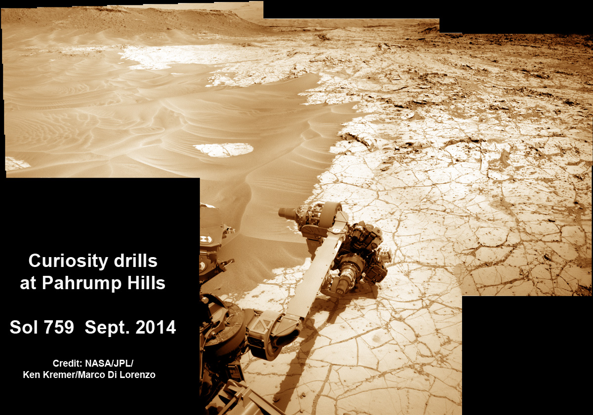
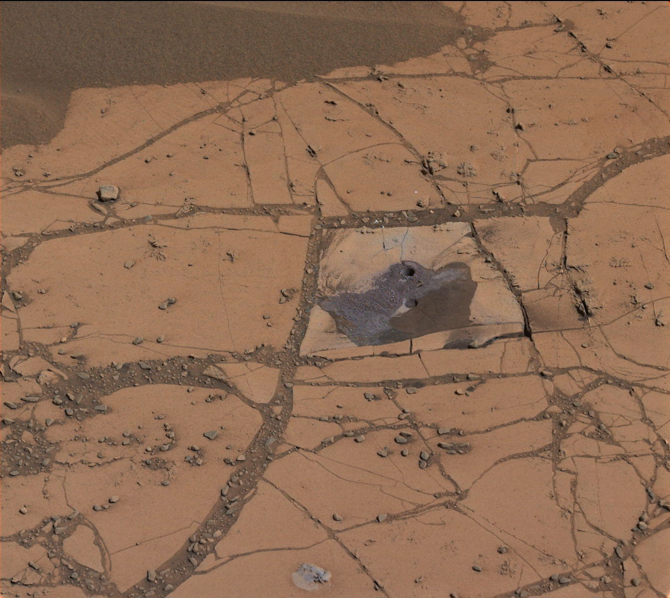
The mineral hematite was discovered in a patch of red rock powder cored from a target at the Pahrump Hills outcrop in late September.
Pahrump Hills is the location of Curiosity’s fourth drill campaign overall, but the first since arriving at the base of Mount Sharp.
See the mosaic herein showing Curiosity’s hammering drill boring into the outcrop.
The Pahrump Hills outcrop represents the first rock formation belonging to Mount Sharp that the rover has investigated since the nail-biting landing more than two years ago, in August 2012. The car-sized rover is now working in the extended phase of the mission.
Mount Sharp was always Curiosity’s primary mission destination. The layered mountain dominates most of the Gale Crater landing site and towers 3.4 miles (5.5 kilometers) into the Martian sky and is taller than Mount Rainier.
This drill sample was specifically collected from a target called “Confidence Hills” within the “Pahrump Hills” outcrop.
The robotic arm was used to deliver a tiny portion of the pulverized powder and feed it into the Chemistry and Mineralogy (CheMin) instrument inside the rover’s belly.
“It contained much more hematite than any rock or soil sample previously analyzed by CheMin during the two-year-old mission. Hematite is an iron-oxide mineral that gives clues about ancient environmental conditions from when it formed,” said NASA in a statement.
Back in 2010, the high-resolution Compact Reconnaissance Imaging Spectrometer for Mars (CRISM) mineral-mapping instrument aboard NASA’s Mars Reconnaissance Orbiter (MRO) provided evidence of hematite in the geological unit that includes the Pahrump Hills outcrop.
“We’ve reached the part of the crater where we have the mineralogical information that was important in selection of Gale Crater as the landing site,” said Ralph Milliken of Brown University, Providence, R.I., in a statement. Milliken is a member of Curiosity’s science team and was lead author of a 2010 report in Geophysical Research Letters identifying minerals based on observations of lower Mount Sharp by CRISM.
“We’re now on a path where the orbital data can help us predict what minerals we’ll find and make good choices about where to drill. Analyses like these will help us place rover-scale observations into the broader geologic history of Gale that we see from orbital data,” said Milliken.
The hematite found in this first sample gathered from the base of Mount Sharp reveals a different set of environmental conditions on Mars that were more oxidizing compared to the earlier drill samples analyzed by Curiosity collected from the Yellowknife Bay area, during the rover’s first year on the Red Planet.
At Yellowknife Bay, the rover found an ancient lakebed and discovered phyllosilicates clay minerals that formed in neutral liquid water billions of years ago and were conducive to the formation of Martin microbes, if they ever existed.
Analysis indicates that the Pahrump Hills sample contains about 8 percent hematite and 4 percent magnetite. Hematite can be formed from magnetite under oxidizing conditions.
By comparison the Yellowknife Bay samples contain at most about one percent hematite and much higher amounts of magnetite.
“There’s more oxidation involved in the new sample,” said CheMin Deputy Principal Investigator David Vaniman of the Planetary Science Institute in Tucson, Ariz.
In recent weeks, Curiosity’s handlers have directed the one-ton behemoth to conduct a walkabout of the Pahrump Hills terrain to search for the most scientifically interesting targets.
NASA says that Curiosity may spend “weeks to months” in pursuit of science here before moving even closer to Mount Sharp and eventually beginning the historic ascent to analyze the mountains geological stacks layer by layer.
So far Curiosity’s odometer totals over 5.5 miles (9.0 kilometers) since landing inside Gale Crater on Mars in August 2012. She has taken some 200,000 images during 800 Sols of exploration.
Stay tuned here for continuing updates.
Want to keep up-to-date with all things space? Be sure to “Like” AmericaSpace on Facebook and follow us on Twitter: @AmericaSpace