
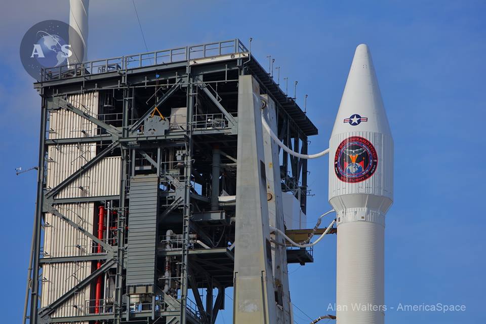
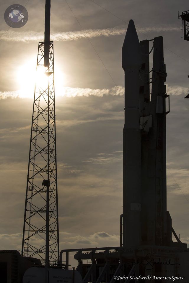
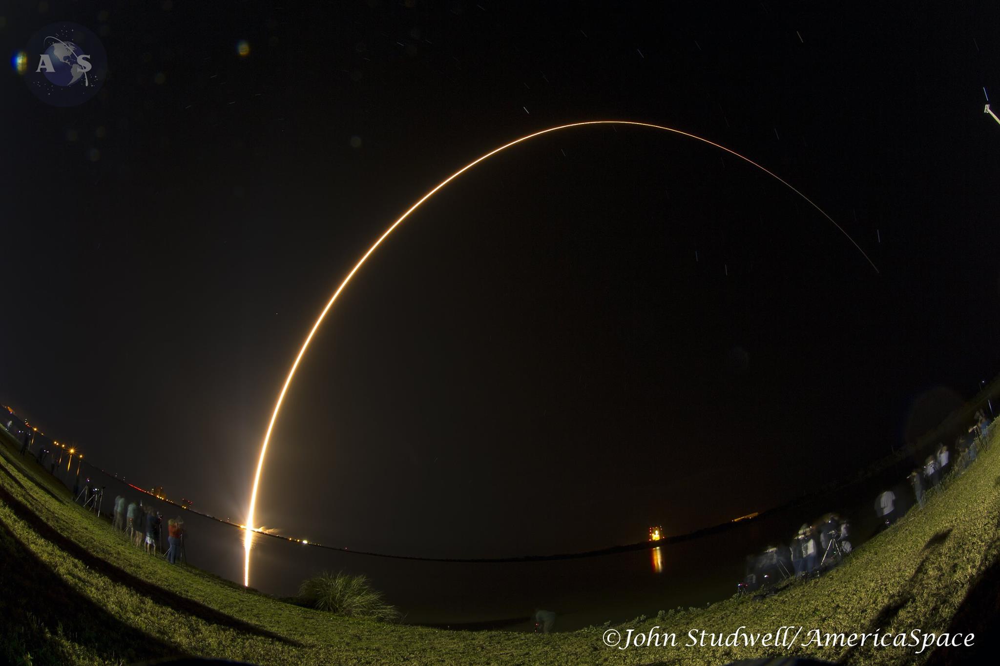
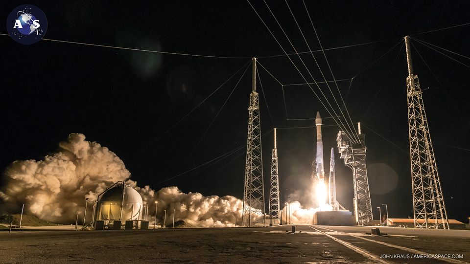
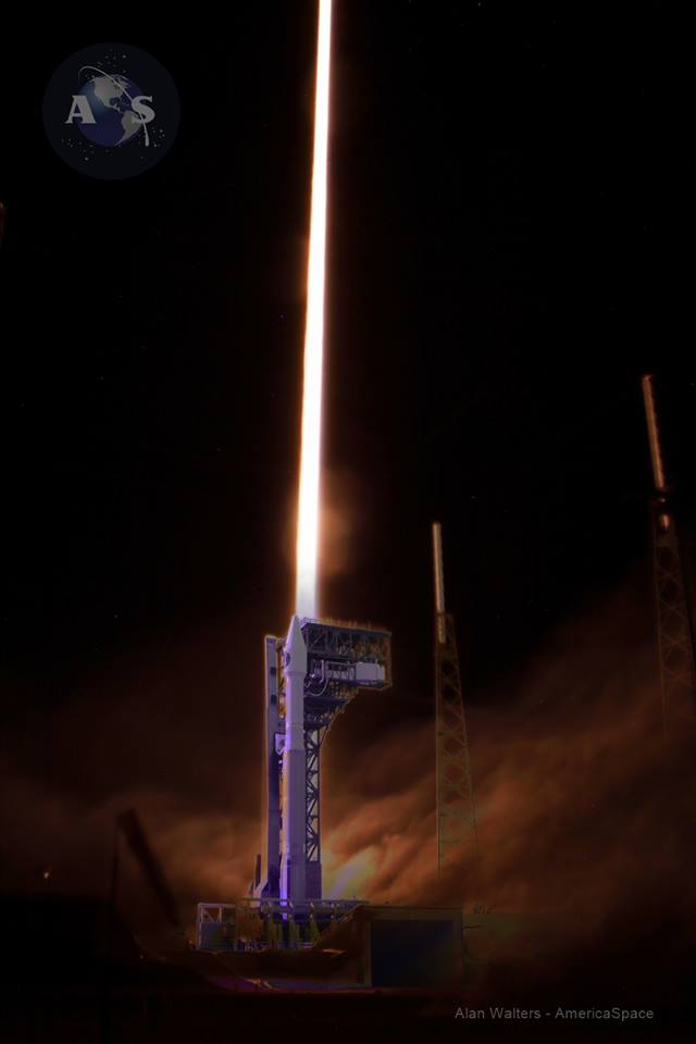
The third Space Based Infrared System Geosynchronous Orbit (SBIRS GEO-3) spacecraft—a critical war fighting satellite and one of the most expensive of all U.S. military space assets—is currently undergoing early checkout in orbit following its successful launch from Cape Canaveral Air Force Station last night, Jan. 20, on a United Launch Alliance (ULA) Atlas V rocket.
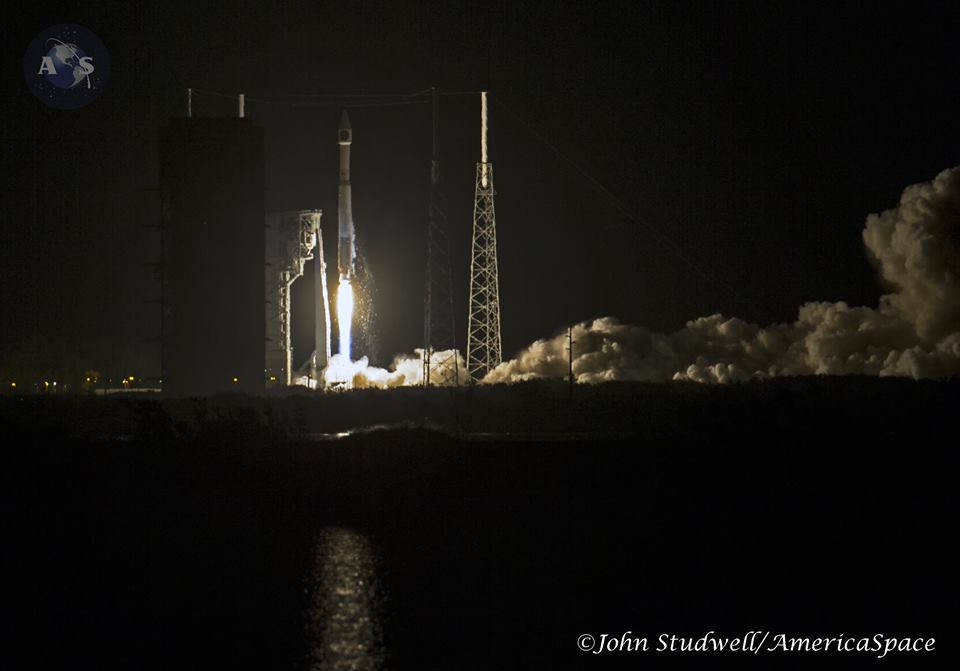
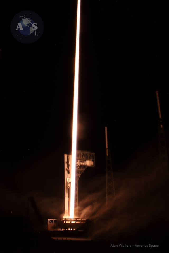
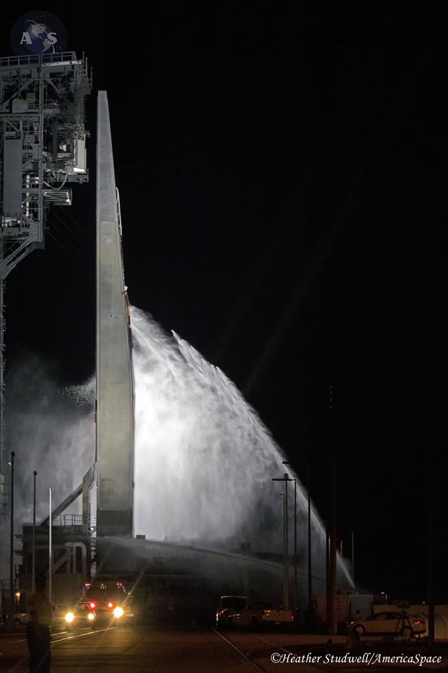
Liftoff of the Atlas V 401 version from Launch Complex 41, on 860,000 pounds of thrust from its Russian Energomash RD-180 engine, occurred at 7:42 p.m. EST, at the opening of a 40-minute launch window. Russian Energomash rocket engineers monitored the launch from their own computer room in the Atlas Spaceflight Operations Center (ASOC). Weather in the area was clear.
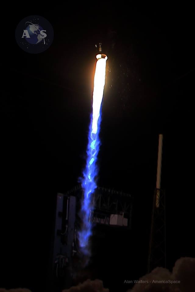
The mission was delayed a day after a countdown scrub Jan. 19 because of RD-180 instrumentation problems and an unauthorized aircraft in the Red Zone. It marks the first of 11 ULA launches planned for 2017.
SBIRS spacecraft are quite literally directly involved in real time war fighting operations from the moment they become operational. This is because of their ability not only to deter a missile attack and help decisions on an immediate nuclear response, but also to see and warn of even small rocket powered artillery, including mortars, fired at the U.S. and allied forces in Iraq, Syria, and Afghanistan. That information is now being released to forces on a real-time basis.
The importance of the SBIRS program is starting to get wide positive recognition. For example, a recent article in Forbes Magazine carried a large headline: “SBIRS: The Pentagon’s Most Important Space Program For Preventing Nuclear War.”
The SBIRS GEO-3 spacecraft has four missions:
— Missile Warning: To spot and calculate impact times and locations for strategic nuclear strikes from Russia, China, North Korea, or Iran or smaller tactical missiles fired at U. S. and allied forces. SBIRS also provides such coverage for Great Britain, France, Australia, and likely also Japan, and to U.S. forces based in South Korea.
— Missile Defense: To guide decision making and employment of Missile Defense interceptors like Ground Based Interceptors based at Eielson AFB near Fairbanks, Alaska, and Vandenberg AFB, Calif., and SM-3 interceptors based on Navy destroyers, and Japanese and Australian destroyers.
— Battlespace Awareness: To use comprehensive IR data to characterize battlespace conditions. In this vein in addition to missiles and impact point calculations, SBIRS are also to detect the especially hot jet engines of airborne military aircraft with hostile intent.
— Technical Intelligence: By reaping huge amounts of data from missile tests made by adversaries. “The SBIRS scanning sensor provides a wide-area surveillance of missile launches and natural phenomena across the Earth, while the staring sensor observes smaller areas of interest with superior sensitivity,” said Dave Sheridan, Lockheed Martin’s SBIRS program manager. The staring sensor specifically provides data on an adversary’s rocket propulsion development in ground tests.
The major milestones following Atlas V liftoff included:
— Max-Q: 1 min. 31 sec.
— Cutoff of Russian RD-180 engine and separation of the 106 ft. long Atlas first stage: 4 min. 03 sec.
— Centaur first ignition of the 22,900 lb. thrust Aerojet Rocketdyne RL10C-1 engine: 14 min. 19 sec.
— Separation of the 14 ft. fairing: 4 min. 27 sec.
— Centaur first cutoff above central Atlantic: 15 min 22 sec.
— Coast phase for about 10 minutes until the vehicle is just off the West African bulge.
— Centaur second ignition: 25 min.
— Centaur second cutoff over the equator just west of Gabon: 28 min.
— Second coast phase for about 13 minutes across southern Africa.
— Spacecraft separation off northern Madagascar into a 19,323 x 100 naut mile geosynchronous transfer orbit at 43 min. 48 sec. after launch.
— After initial orbital checkout start climb to geosynchronous orbit with about seven firings of the spacecraft’s liquid apogee engine through the end of January.
— Several months of sensor calibration and spacecraft testing until SBIRS GEO-3 is moved to its secret operational location and declared operational by mid-2017.
“The addition of GEO-3 adds to the GEO-1 and 2 capability and provides a wider area of the Earth that we get that higher sensitivity to detect dimmer and shorter burning missiles,” said Col. Dennis Bythewood, director of the Remote Sensing Systems Directorate at the Air Force’s Space and Missile Systems Center.
The launch of GEO 4 planned in November “will finalize the baseline SBIRS program and put worldwide SBIRS geosynchronous capability on orbit,” said Bythewood. The combined GEO and HEO spacecraft now provide a 50 percent improvement in the systems detection and track capability.
The completion of the constellation late this year with GEO-4 is far behind schedule and over budget.
For example, the 15,000-lb Air Force Mobile User Objective System cost $611 million, while the 10,000-lb SBIRS GEO-3 cost $1.2 billion.
“The ambitious SBIRS GEO satellite design came to life after years of technical hurdles and cost overruns,” said Aviation Week. “A large rectangular sun shade was added to the design after engineers realized the scanning and staring sensor faces would be exposed to too much heat and glint from the Sun.”
Later, electromagnetic interference problems befuddled designers and delayed the program as did a computer processing timing issue that held up the first GEO launch, for years, said Aviation Week in a late 2015 article.
For the first time, infrared data from the Lockheed Martin satellites for new military and civilian uses at the Air Force’s recently opened data utilization lab in Boulder, Colo.
While SBIRS’s primary mission is strategic missile warning, the system can support a wide range of research and development projects across the field of remote sensing, which is the monitoring, observing, and gathering of information on the Earth and atmosphere from space.
“By giving researchers access to this data, our objective is for them to find new, innovative uses for improving situational awareness—whether it is for tactical military missions, natural disasters or even firefighting,” said David Sheridan, vice president of Lockheed Martin’s Overhead Persistent Infrared (OPIR) systems mission area.
In the past year, the Air Force has seen a growing demand from the military, intelligence, and civil communities, as well as academia, for remote sensing capabilities. For areas like battlespace awareness, intelligence, and 24/7 tactical alerts, promising solutions developed in the lab will be considered for operational applications at the SBIRS Mission Control Station, OPIR Battlespace Awareness Center at Buckley Air Force Base, Colo.
“In an effort to develop, test and transition new or enhanced capabilities, the data utilization lab will provide an opportunity for users, data consumers and third-party developers to access these sensor feeds—providing an open framework architecture to host new tools, algorithms and processing solutions,” said Lt. Colonel Ross Johnston of the Air Force Space and Missile Systems Center.
Along with government and industry teams, academic organizations like the University of Colorado will use the data provided by the lab to facilitate collaboration and support research in areas that include monitoring the Earth’s surface to determine the potential for forest fires or informing critical decisions during active fires.
“The benefit of having public-private partnerships is that we can bring together different stakeholders, in addition to doing research, and understand how we can use data from space assets to solve societal issues,” said Scott Palo, associate dean for research at the University of Colorado’s College of Engineering and Applied Science. “We can also provide opportunities for students, as well as small and medium-sized businesses, to connect with industry and government and develop a broader vision that we can all build upon.”
.


.
Be sure to “LIKE” AmericaSpace on Facebook and follow us on Instagram & Twitter!
.
Missions » SBIRS » Missions » SBIRS » GEO 3 »

FABULOUS!!!!!!!!