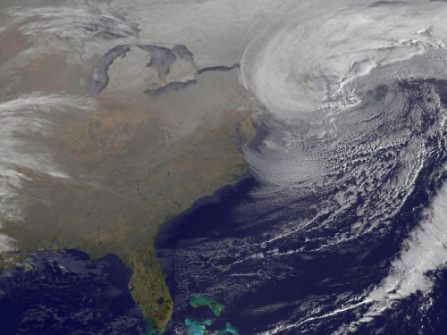
NASA’s GOES-13 spacecraft has captured this stunning image of the monster blizzard which has struck the United States’ East Coast. The orbiting satellite snapped this image on Feb.9 at 7:01 a.m. EST. The nor’easter is clearly visible barreling down on the U.S. and Canadian East Coast.
The massive snow storm is blamed for at least nine deaths in the U.S. and Canada. The storm formed blizzards that stretched from Massachusetts to New York, dumping tons of snow in its wake.
The GOES-13 spacecraft was launched on May 24, 2006, atop a United Launch Alliance Delta IV rocket from Cape Canaveral Air Force Station’s Space Launch Complex 37B in Florida. The spacecraft is part of the National Oceanic and Atmospheric Administration’s Geostationary Operational Environmental Satellite system.