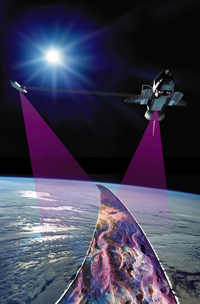
At the dawn of the year 2000, more precise radar maps existed of Venus—thanks to NASA’s Magellan imaging spacecraft—than of our own Home Planet. Although areas of Earth had been digitally mapped at resolutions of 100 feet (30 meters), the vast majority of the world lacked such reliable data, primarily due to cloud cover in equatorial regions, which precluded imaging by optical satellites or aircraft. “Humans always want to know about their environment,” said German astronaut Gerhard Thiele, “and for the first time we will generate a coherent data set; a picture of the Earth.” Fifteen years ago, this week, Thiele and his five STS-99 crewmates launched aboard Endeavour on the ambitious $220 million Shuttle Radar Topography Mission (SRTM), tasked with utilizing an innovative technique to assemble the most comprehensive maps of our world to date. Although it has since been enhanced by more modern technologies, SRTM had generated 750,000 confirmed users of its data sets by mid-2011 and its resources have been accessed by people in 221 countries.
Right from the start, SRTM was an affair which transcended nations. Spearheaded by NASA and the Department of Defense’s National Imaging and Mapping Agency (NIMA), and supported by the German and Italian space agencies, it would operate from a high-inclination orbit of 57 degrees and employ hardware which had previously seen use on the first and second Space Radar Laboratory (SRL) missions in April and September 1994. The six-member crew—Commander Kevin Kregel, Pilot Dom Gorie, and Mission Specialists Thiele, Janet Kavandi, Janice Voss, and Japan’s Mamoru Mohri—were assigned to STS-99 in October 1998, with an original target launch date in mid-September of the following year. “During the mission, the crew will use specialized radar equipment and other electronics to map 80 percent of the Earth’s land mass, extending from the southern tip of Greenland to the northern edge of the Antarctic Circle,” NASA revealed, with a swath from 60 degrees North to 56 degrees South latitude. “Data targets will be spaced approximately every 90 feet (27.4 meters) and the resulting image should be accurate to within 30 feet (9 meters) of the height of the terrain.”
During their 11 days in space, the crew would perform in excess of 1,000 “data-takes,” operating in two 12-hour shifts, using 29,980 pounds (13,600 kg) of radar instruments both inside and outside Endeavour’s cavernous payload bay. The two main SRTM instruments, affixed to a Spacelab pallet, were NASA’s third-generation Shuttle Imaging Radar (SIR-C) and the joint German/Italian X-band Synthetic Aperture Radar (X-SAR), both of which flew on the two SRL missions. These instruments would transmit microwaves at C- and X-band wavelengths toward the surface and gather the reflected echoes on two separate receivers. SIR-C offered multi-frequency, multi-polarization imagery and represented the first space-borne radar with the ability to transmit and receive horizontally and vertically polarized waves at both the L- and C-band wavelengths.
Measuring 39 feet (12 meters) long and 13 feet (4 meters) wide, SIR-C was the most massive piece of flight hardware ever built at the Jet Propulsion Laboratory (JPL) in Pasadena, Calif. It was a Synthetic Aperture Radar (SAR) and filled almost half of Endeavour’s payload bay for STS-99. Originally assembled from spares left over from NASA’s 1978 Seasat mission, SIR-C was affixed to its own truss support structure, which, in turn, was mounted onto a Spacelab pallet, providing a “side-looking” viewing angle, some 47 degrees from the nadir. As a result, during data-gathering operations, the shuttle was required to reorient itself to precisely direct SIR-C at its ground targets. Its radar beam was formed from hundreds of transmitters, embedded within the surface of the antenna. By properly adjusting the energy from these transmitted, the beam could be electronically “steered” and, when combined with shuttle maneuvers, offered the scope to acquire images from various directions. However, SIR-C was not the only radar in the payload bay for SRTM. Running like a strip along the uppermost edge of SIR-C was “X-SAR,” a 39-foot (12-meter) x 1.3-foot (40 cm) synthetic-aperture device, built by a partnership of organizations, including the German Dornier and Italian Alenia Spazio companies, together with the German and Italian space agencies, which offered a single-polarization radar, operating in the X-band. It was designed to be mechanically aligned with the L-band and C-band beams of SIR-C.
With the SIR-C/X-SAR combo serving as one of SRTM’s two receivers (dubbed the “Main Antenna”), the second receiver (known as the “Outboard Antenna”) was mounted at the end of a 200-foot-long (60-meter) mast, which extended “sideways” into space over the shuttle’s payload bay wall. Radar “echoes” from the instruments were captured, amplified, and their data recorded on digital tapes for post-flight analysis. It was also expected to be possible to downlink data from one of the radar frequencies in real time to ground-based researchers, through NASA’s Tracking and Data Relay Satellite (TDRS) constellation.
Interferometry as a radar-mapping technique was not entirely new ground for the shuttle, since it was first demonstrated at the end of the SRL-2 mission. However, since that mission only carried the SIR-C/X-SAR payload and was not equipped with a mast-mounted outboard antenna, the SRL-2 crew had to fly over the same patch of ground track and acquire two radar images over separate orbital passes. In effect, it was only possible to achieve “multiple-pass interferometry,” rather than acquiring the data in a single orbital pass. Moreover, the shuttle’s altitude and the relative instability of its attitude meant that it could only collect useful interferometry data with the L-band capability of SIR-C. Nevertheless, the seed of an idea was planted for a fixed-baseline, single-pass interferometer, and on 8 July 1996 a formal Memorandum of Understanding (MOU) between NASA and the Department of Defense to develop SRTM had crystallized into a proposal for a future shuttle payload.
The payload carried the elements of the first fully-equipped, single-pass interferometer ever carried aboard the shuttle, capable of taking two simultaneous images of Earth from slightly different locations and at different frequencies, to be combined into high-resolution, three-dimensional topographical maps for a wide range of civilian, military, and scientific purposes. The presence of the outboard antenna on SRTM allowed this interferometric data to be gathered with greater efficiency at C- and X-band frequencies. Since it would be possible to acquire both images in the same orbital pass, the potential data return was expected to be significantly higher. In the words of STS-99 Commander Kevin Kregel, operating two antennas in this manner, was akin to acquiring two radar images, 200 feet (60 meters) apart, “and that gives us the capability to get the 3D image.”
The outboard antenna and its 200-foot (60-meter) mast were to be deployed from a 9.5-foot (2.9-meter) canister, which was also mounted onto the Spacelab pallet, next to the main antenna, and would represent the real novelty of SRTM. Its design was based upon the same technology used for the truss members destined for the International Space Station (ISS), and it was fabricated by AEC-ABLE Engineering of Goleta, Calif., which also built a mast to support the Tethered Satellite System (TSS) on two earlier shuttle missions in July 1992 and February 1996. It consisted of carbon-fiber-reinforced plastic, stainless steel, alpha titanium, and an iron-nickel alloy, known as “Invar.” Officially designated the “ABLE Deployable Articulated Mast” (ADAM), when fully extended the 640-pound (290-kg) device represented the longest rigid structure ever deployed from the shuttle.
During its launch and re-entry phases, the mast was folded up in a manner not dissimilar to a giant accordion in its canister. Once described by Gerhard Thiele as nothing short of a “miracle,” the mast was deployed in space by means of a rotating nut, which grasped the edges and corners and pushed them outward into a succession of 87 almost-perfect “cubes.” It was designed to deploy successfully without twisting, which allowed it to house electrical wiring, fiber-optic cables, and gas thruster lines along its entire length to connect the outboard antenna with the instruments in the payload bay. AEC-ABLE also guaranteed that the mast would remain stable to within 0.8 inches (2 cm) of total tip displacement, which was considered essential if the radar-mapping standards demanded of SRTM were to be met. At the mast’s tip was the outboard antenna itself, which had been assembled from spares left over from the two SRL missions, and included C-band and X-band passive receiver panels to collect radar echoes from the SIR-C/X-SAR transmissions.
In spite of the exciting nature of its scientific potential, STS-99 was a long time coming. When its six-strong crew were announced by NASA in October 1998, they confidently anticipated launching in September of the following year, on an 11-day flight. By the middle of July 1999, the SRTM hardware had been loaded into Endeavour’s payload bay in the Orbiter Processing Facility (OPF) at the Kennedy Space Center (KSC), ready for the rollover to the Vehicle Assembly Building (VAB) in August for stacking onto her External Tank (ET) and Solid Rocket Boosters (SRBs). Unfortunately, STS-99 and several other shuttle missions met with significant delay in the summer and winter of 1999, following extensive wiring defects which impacted the entire fleet of orbiters. In order to inspect Endeavour’s wiring, the SRTM hardware had to be removed from the payload bay, and the STS-99 launch was postponed until at least early October. A bent freon line on SRTM, later repaired with a brace, added to the problems, but by early December the wiring inspections were completed, and on the 13th the shuttle stack was rolled out to Pad 39A, tracking an opening launch attempt in mid-January 2000.
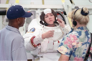
This date soon became untenable, following lengthy delays to the previous shuttle mission, STS-103, which eventually flew over Christmas 1999. A new launch target of 31 January was established and countdown operations ran smoothly, and the crew suited up and were strapped into their seats aboard Endeavour. Unfortunately, they were thwarted by doubtful weather conditions, including low clouds and rain at KSC, and by a potential problem with an on-board Master Events Controller (MEC). The latter was housed in avionics boxes within the shuttle’s main engine compartment, and the countdown clock was held at the T-20-minute mark, then scrubbed for 24 hours when engineers could not replicate the exact cause of the problem. At length, the Mission Management Team (MMT) opted to play it safe and replace the MEC. Although removal and replacement was fairly straightforward, the function of the MEC was entwined with a number of pyrotechnic operations, which firstly required the safing of pyrotechnics, then the removal and replacement procedure itself, and then the reinstallation and reactivation of the pyrotechnics.
This pushed back the STS-99 launch until no earlier than 9 February. This was also moved 48 hours to the right, due to the countdown demonstration test on the 10th of a Titan IV booster at nearby Cape Canaveral Air Force Station, which required Eastern Range tracking support. Eventually, on the 11th, despite minor technical issues associated with cabin leak checks, a hydraulic recirculation pump, and a liquid hydrogen manifold tank heater, Endeavour passed smoothly through the final stages of the countdown and rocketed into orbit at 12:43 p.m. EST.
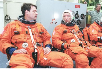
Within hours of entering space, the crew divided into its two teams, with the “blue shift” of Gorie, Voss, and Mohri setting up a network of laptop computers, then heading to bed for an abbreviated, six-hour sleep period. Meanwhile, the “red shift” of Kregel, Kavandi, and Thiele began activating the activation of the SRTM payload, its instruments, and deploying its outboard antenna. Since both Kavandi (EV1) and Thiele (EV2) had been specifically trained to perform a contingency spacewalk to manually unfurl or retrieve the mast in the event of problems, it made sense for Kregel to assign them to the same shift, as well as to the shift which began the deployment process.
Had problems arisen with the mast during this critical phase, Kavandi and Thiele would have embarked on an EVA to decouple its motors and manually drive it open or closed with a power wrench. The trio initiated the extension of the mast at 6:27 p.m. EST, and all 87 cube-shaped bays had been successfully deployed from their canister within 17 minutes, reaching a maximum length of 200 feet (60 metres) from Endeavour’s port side. The astronauts maneuvered Endeavour into the correct mapping attitude, with the orbiter’s tail facing into the direction of travel, and under Kregel’s direction executed a series of thruster firings to test the ability of dampers to absorb the force of maneuvers and keep both the main and outboard antennas correctly aligned with their targets. By the time Kregel, Kavandi, and Thiele retired to sleep at about 10:45 p.m. EST, about 10 hours after launch, they had triumphantly executed STS-99’s most complex task. The radar mission was underway.
The second part of this article will appear tomorrow.
Want to keep up-to-date with all things space? Be sure to “Like” AmericaSpace on Facebook and follow us on Twitter: @AmericaSpace



I got to see this mission launch in person. My family and I were on a business trip and intended to be at the Cape during the Endeavour’s landing but by the grace of God the mission was pushed back far enough that we were able to be there during the launch.
I remember that morning as we were sitting in the hotel dining area planning where to go to see the launch that a stranger walked up to us. He introduced himself as a family member of one of the crew (if I remember correctly his brother was Dominic Gorie the pilot but I can’t be certain). He had noticed that we were planning where to see the launch and he had a proposition for us. He explained that some other family members were unable to attend the launch and that he could give us their passes so we could get on the base and be closer to the launch. He didn’t ask for money or anything. He just gave them to us. We eagerly accepted and as a result were able to get closer to the launch site than the general public.
The launch was beyond amazing. My 8-year old mind was blown. I remember the noise and seeing the exhaust pour out of the shuttle as it lifted off. I remember staring and watching it sour for the 5 or so minutes it was visible in the clear blue sky. It was one of the greatest moments of my life and I will never forget it.
I’d like to see SLS launch a dedicated Space Based Radar up there myself.