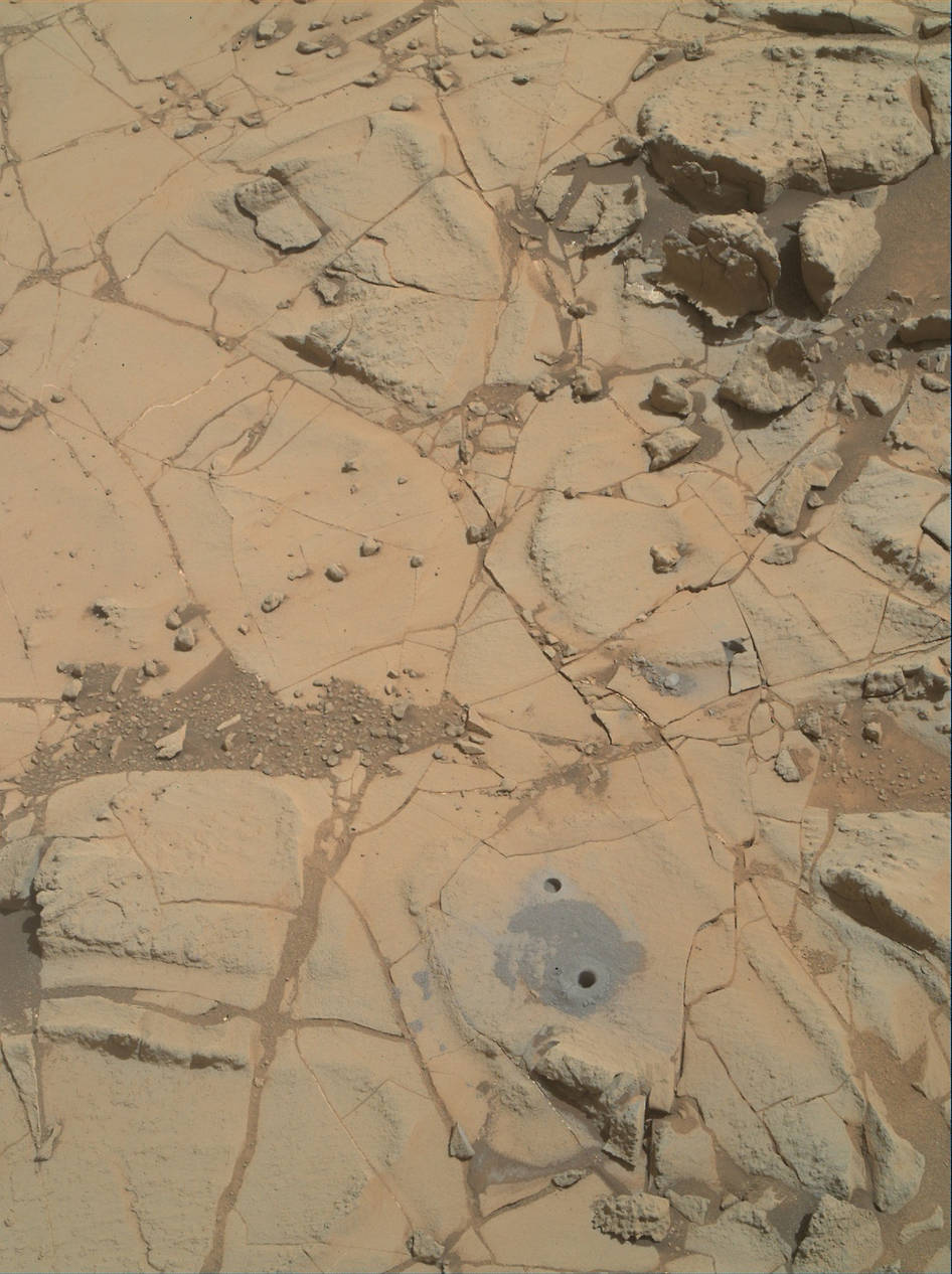
NASA’s Curiosity Mars Science Laboratory rover has taken a second “bite” out of the base layer of the Martian mountain she is currently investigating, and found that it’s been altered by water that’s a different flavor and more acidic than the first “bite.”
Curiosity has been surveying the base of Mount Sharp for the past five months, since arriving there last fall in search of scientifically interesting candidates for drilling to elucidate the history of habitability.
The first “bite” taken from the mountain base was at a nearby target called “Confidence Hills” during September 2014. The rover then conducted a “walkabout” to scout out the area for the best places to drill. “Mojave” topped the list.
Mount Sharp is comprised of sedimentary rock layers that record the history of ancient Martian environments and is the primary destination of the mission.
The mountain towers 3.4 miles (5.5 kilometers) into the Martian sky and dominates the center of the Gale Crater where Curiosity safely touched down some 30 months ago, in August 2012.
The six-wheeled robot spent her first two years at Gale by driving and drilling across the crater floor before reaching the base of Mount Sharp.
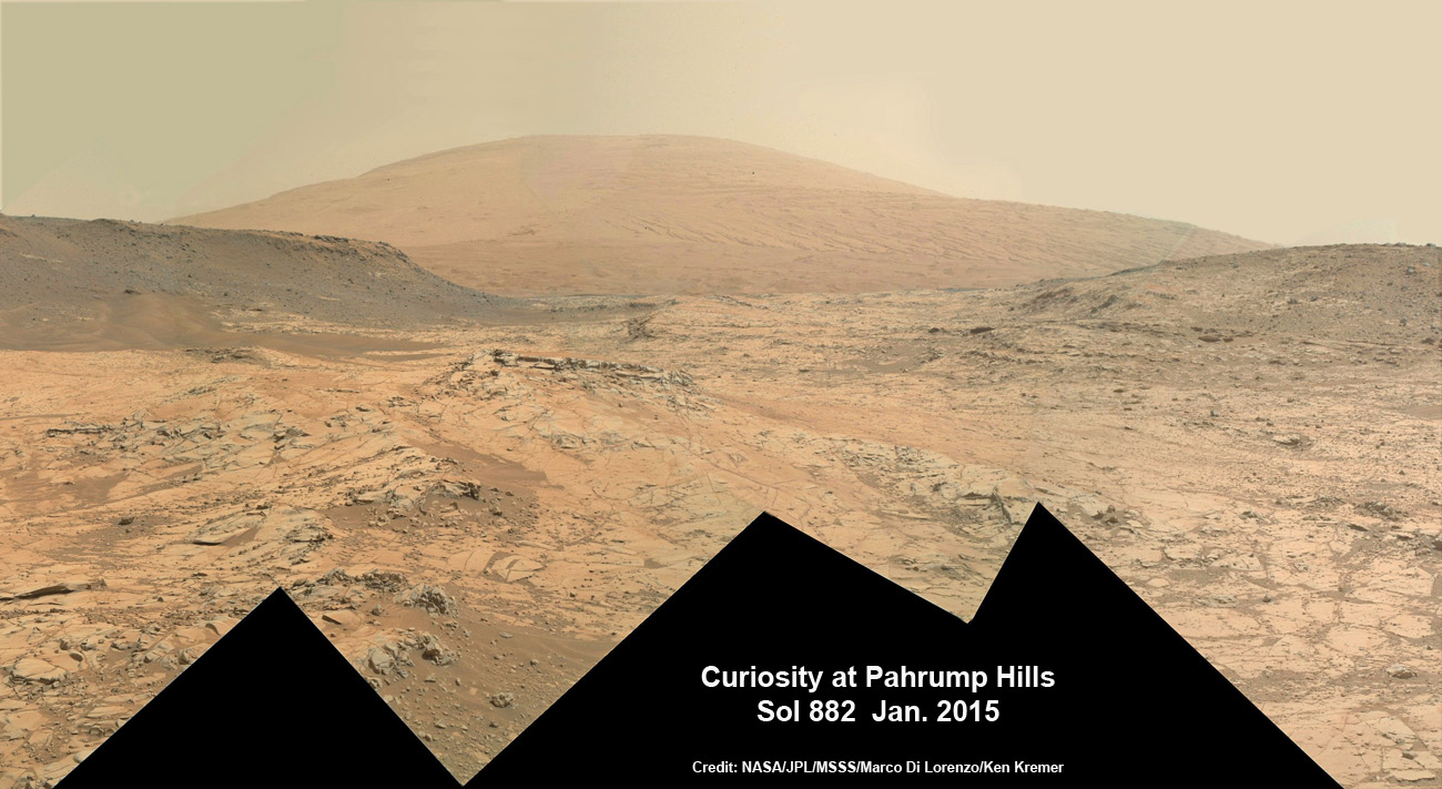
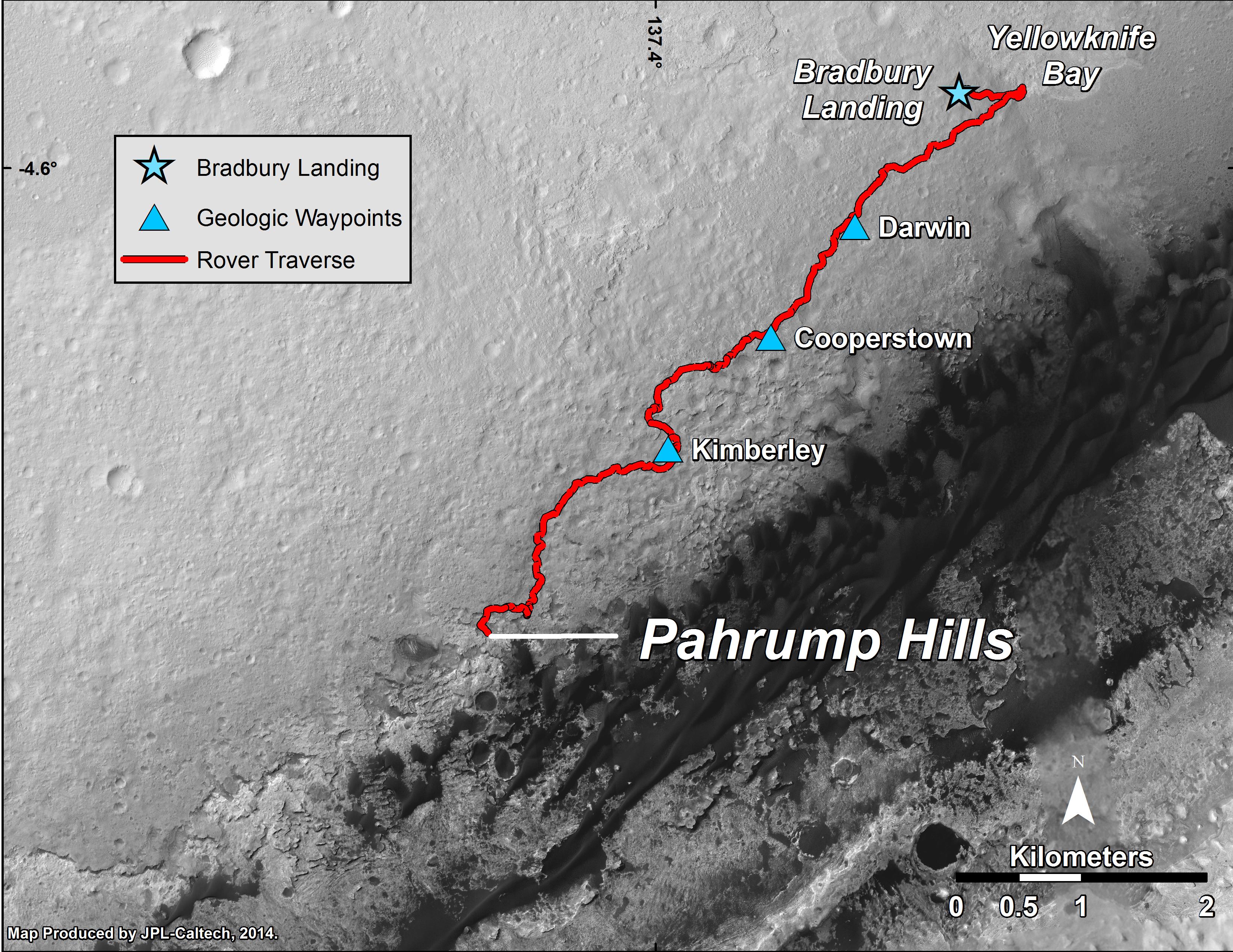
The new drilling campaign was carried out at a crystal-rich rock target named “Mojave 2” that lies in the “Pink Cliffs” portion of a outcrop called “Pahrump Hills,” an exposure of the Murray formation that is the basal geological unit of Mount Sharp. See the location in the annotated scene below.
Curiosity bored the “Mojave 2” sample-collection hole on Sol 882 (Jan. 29) to a full depth of about 2.6 inches (6.5 centimeters). The rotary-percussive drill successfully cut a hole about 0.63 inch (1.6 centimeters) in diameter.
As always the team commanded Curiosity to first check out the suitability of the site for full depth sample-collection drilling with a precursor mini-drill test that was successfully completed the sol before.
Rock powder from “Mojave 2” was successfully delivered to both of the onboard miniaturized chemistry labs in the rovers belly: CheMin and SAM.
Imagery taken by the Mast mounted cameras and arm mounted MAHLI camera confirmed the success of the sample drilling and delivery operations at “Mojave 2.”
Powder was delivered first to the Chemistry and Mineralogy (CheMin) instrument and a quick check of the results “shows a significant amount of jarosite, an oxidized mineral containing iron and sulfur that forms in acidic environments,” according to NASA.
“Our initial assessment of the newest sample indicates that it has much more jarosite than Confidence Hills,” said CheMin Deputy Principal Investigator David Vaniman, of the Planetary Science Institute, Tucson, Ariz., in a statement. This data stands in contrast to the minerals in the Confidence Hills sample, which indicate less acidic conditions of formation.
“Open questions include whether the more acidic water evident at Mojave 2 was part of environmental conditions when sediments building the mountain were first deposited, or fluid that soaked the site later.”
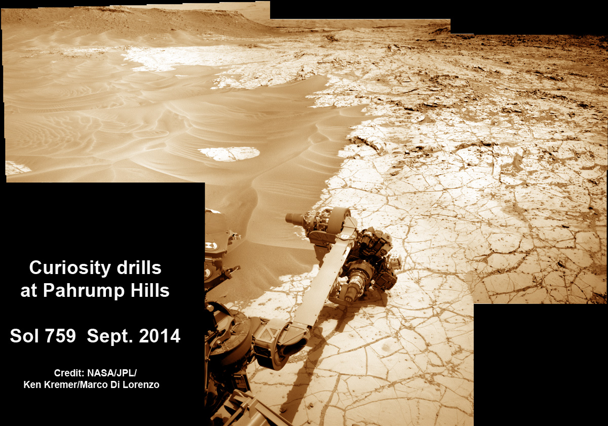
For the “Mojave 2” campaign, the team also significantly modified how they operate the rotary-percussion drill to be less impactful onto the rocks because the rocks in the Mojave site turned out to be softer than expected.
In early January, during the first mini-drill test into a rock target at the site called simply “Mojave,” it broke apart easily, sending rock fragments flying. Therefore, it was to risky to proceed with full-depth drilling because of concern for damage to the instrument.
After much lab testing back on Earth, the team used a less-forceful hammering technique onto the fragile rocks at the Mojave site.
The drill has six percussion-levels settings ranging nearly 20-fold in energy—from tapping gently to banging vigorously—all at 30 times per second, says NASA.
Mojave 2 was drilled using just the level one and two settings of percussion energy and was completed in the normal time of about 10 minutes. All prior Curiosity drill campaigns were conducted at level four.
“This was our first use of low-percussion drilling on Mars, designed to reduce the energy we impart to the rock,” said JPL’s John Michael Morookian, the team’s surface science and sampling activity lead for the Pahrump Hills campaign.
“Curiosity’s drill is essentially a hammer and chisel, and this gives us a way not to hammer as hard.”
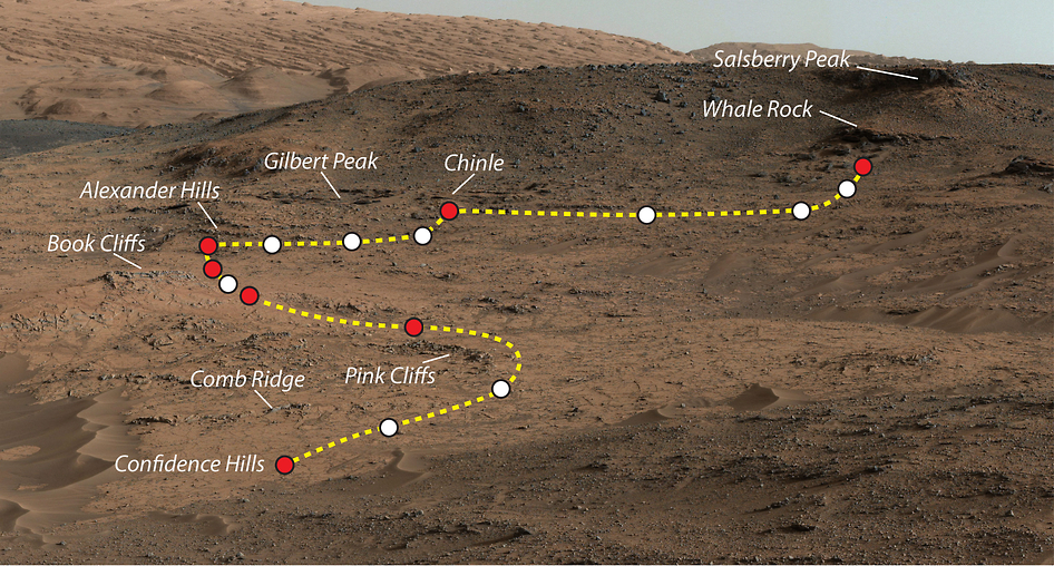
The team is now evaluating whether to conduct one or two more sampling campaigns at the Pahrump Hills before moving onward and upward on Mount Sharp.
So far Curiosity’s odometer totals over 5.5 miles (9.0 kilometers) since landing inside Gale Crater on Mars in August 2012. She has taken some 215,000 images during over 890 Sols of exploration.
Meanwhile, older sister rover Opportunity just climbed to the summit of Cape Tribulation along Endeavour crater on the opposite side of Mars as she celebrated her astonishing 11th anniversary roving the Red Planet!
She captured breathtaking panoramas from the highest peak she will ever climb. See the panoramic mosaic created from raw images by Marco Di Lorenzo and Ken Kremer here.
Despite all those accomplishments, the White House is trying to “Kill Opportunity.” Details here.
Stay tuned here for continuing updates from Mars and throughout our Solar System!
Want to keep up-to-date with all things space? Be sure to “Like” AmericaSpace on Facebook and follow us on Twitter: @AmericaSpace


One Comment
One Ping
Pingback:Weekly Links