To say that NASA’s Mars Helicopter, known as Ingenuity, has been successful would be an understatement. The drone-like quadcopter, specifically designed for Mars’ thin atmosphere, just completed its ninth flight on July 5. It travelled further than ever before, and the new “bird’s eye” images it took will help the Perseverance rover to locate the best rock formations to investigate as well as avoid possible obstacles. The rover itself is also now preparing to take its first samples of Martian rock for analysis, as announced this morning during a NASA press briefing.
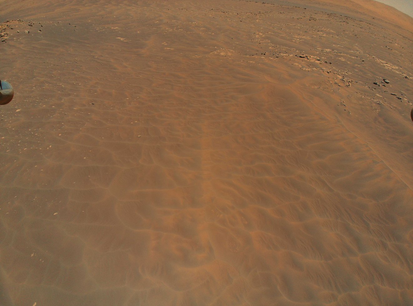
For example, during this flight, the helicopter flew over a dune field called “Séítah.” These dunes, ranging from knee-high to waist-high, would be treacherous for the rover to attempt to cross over, so Perseverance will make a detour around them instead.
“Sand is a big concern,” said JPL’s Olivier Toupet, who leads the team of mobility experts that plans Perseverance’s drives. “If we drive downhill into a dune, we could embed ourselves into it and not be able to get back out.”
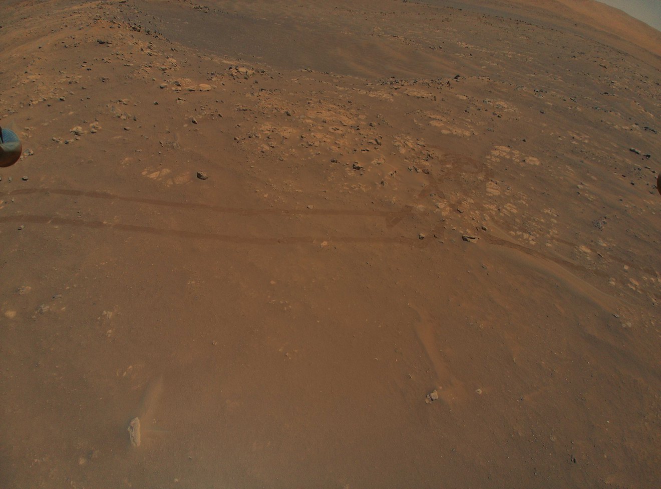
The rover has a new AutoNav system, which used artificial intelligence (AI). It works well for avoiding large rocks and other obstacles, but can’t detect sand. Therefore, human controllers are still needed to make sure the rover doesn’t embed itself in a sand dune and risk being permanently stuck (which did happen with the Spirit rover, sadly).
This is Ingenuity’s primary mission, to act as a scout for the rover. Although this is still an initial test of the technology, the helicopter has already shown itself to be a valuable companion for this and future rovers.
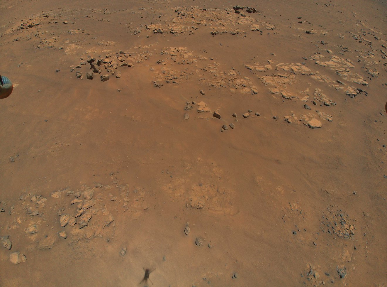
The images taken by Ingenuity are not only stunning to look at, they are also historic. This is the first time that a powered aircraft of any kind has ever been flown in the atmosphere of another planet.
The images offer a bird’s eye view of the terrain and show more detail than images taken from orbit. NASA’s Mars Reconnaissance Orbiter can see rocks as small as about 3 feet (1 meter) from orbit, which is very impressive, but the helicopter can see much greater detail than that.
The new color photos were taken from an altitude of 33 feet (10 meters).
“Once a rover gets close enough to a location, we get ground-scale images that we can compare to orbital images,” said Perseverance Deputy Project Scientist Ken Williford of NASA’s Jet Propulsion Laboratory in Southern California. “With Ingenuity, we now have this intermediate-scale imagery that nicely fills the gap in resolution.”
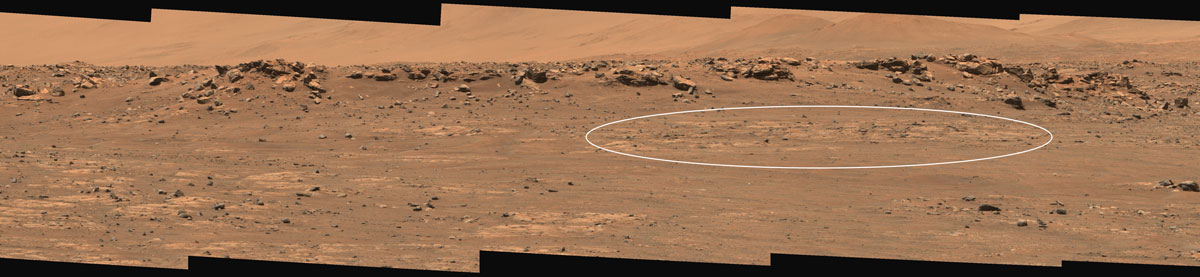
One set of intriguing rock features that Ingenuity has photographed is called “Raised Ridges.” These ridges are part of a fracture system, where water may have once flowed below the surface. Scientists already know that the crater that Perseverance is in, Jezero Crater, used to be a lake a few billion years ago. If there was once water in the fractures, that would have been a great place for minerals to feed colonies of microbes.
The rover team wants to visit Raised Ridges a bit later with the rover itself.
“Our current plan is to visit Raised Ridges and investigate it close up,” Williford said. “The helicopter’s images are by far better in resolution than the orbital ones we were using. Studying these will allow us to ensure that visiting these ridges is important to the team.”
Mission scientists also want to study bedrock that used to lie at the bottom of the lake, as they navigate around the dunes. That bedrock could hold precious clues as to the conditions in the lake at the time it existed, and whether the lake was habitable.
“The helicopter is an extremely valuable asset for rover planning because it provides high-resolution imagery of the terrain we want to drive through,” said Toupet. “We can better assess the size of the dunes and where bedrock is poking out. That’s great information for us; it helps identify which areas may be traversable by the rover and whether certain high-value science targets are reachable.”
On April 26, 2021, Perseverance took the first-ever “selfie” of itself and Ingenuity sitting on the ground about 30 feet (3.9 meters) away.
“The thing that took the most attention was getting Ingenuity into the right place in the selfie,” said Mike Ravine, Advanced Projects Manager at MSSS. “Given how small it is, I thought we did a pretty good job.”
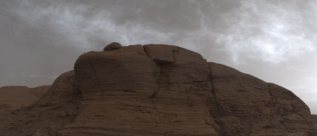
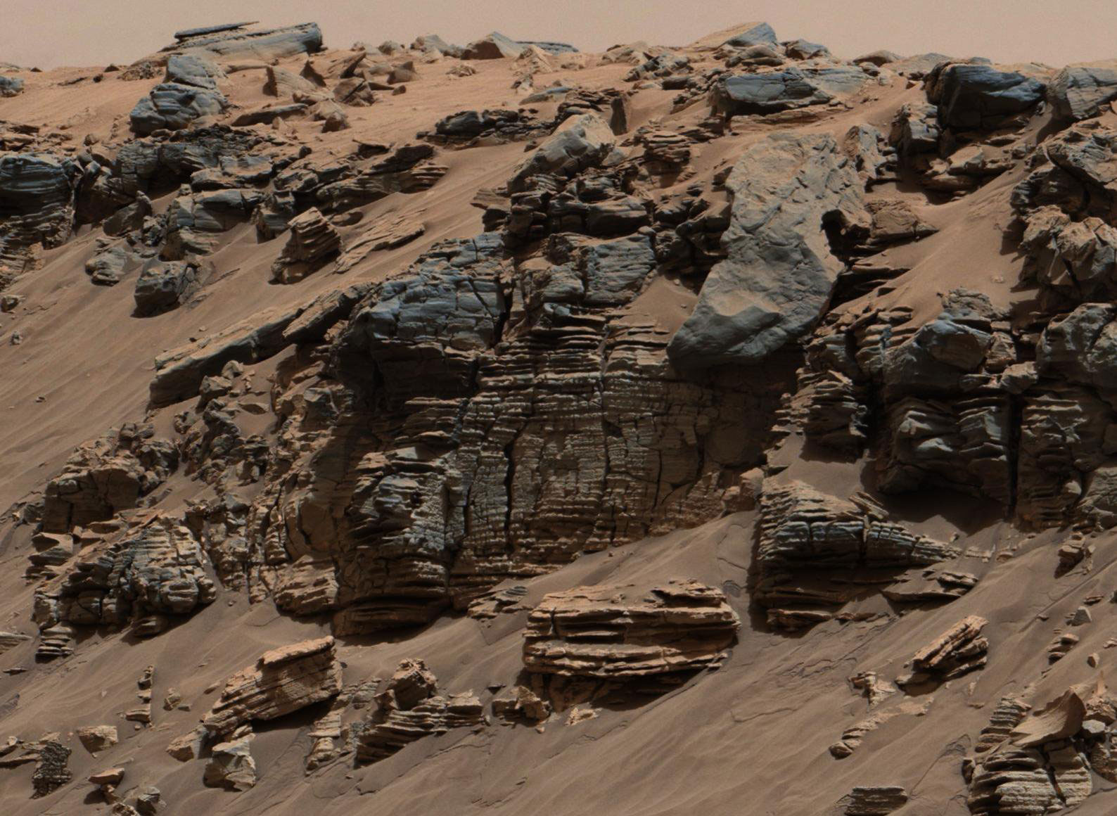
Perseverance also recently took some intriguing images of an escarpment – a long steep slope at the edge of a plateau – named the “Delta Scarp.” The images show both conglomerates and cross-bedding, more evidence of past water.
“I’ve been studying Jezero Crater for years and must have looked at orbital images of the Delta Scarp over a thousand times,” said Vivian Sun at JPL. “But you can only learn so much from orbit, and when this image of the scarp came down to Earth from the rover after landing, it literally took my breath away. This is a favorite because for the first time I could see actual evidence of the conglomerates and cross-bedding we had hypothesized.”
“We’ve known for a while that billions of years ago the Jezero’s Delta Scarp was home to a rushing river,” said Sun. “Now we know we’ll be able to see evidence of this river system up close, getting a better idea of its size and strength of the water rushing through it. And because the river deposited sediments and other material at the scarp from not only inside Jezero but outside as well, it should be an amazing location to look for signs of ancient life.”
Mission scientists are hoping to explore Delta Scarp up-close during Perseverance’s second science campaign sometime next year.
Perseverance’s primary mission is to search for evidence of ancient microbial life. Jezero Crater, where the rover landed, was once home to a lake and a flowing river once cut through the crater wall, leaving behind a delta on the crater floor that can still be clearly seen today. With evidence for sediments and clays, this is a prime region to look for such evidence. This is the first mission since the Viking landers in the late 1970s/early 1980s to look directly for evidence of life rather than just past habitability.
Perseverance is also storing some of the samples it obtains of rock and soil, which will be sent back to Earth for detailed analysis sometime next decade. If successful, this will be the first-ever sample-return from Mars. As announced on July 21 at a NASA press briefing, the mission team is now preparing for its first sample acquisition within the next couple weeks.
“When Neil Armstrong took the first sample from the Sea of Tranquility 52 years ago, he began a process that would rewrite what humanity knew about the Moon,” said Thomas Zurbuchen, associate administrator for science at NASA Headquarters. “I have every expectation that Perseverance’s first sample from Jezero Crater, and those that come after, will do the same for Mars. We are on the threshold of a new era of planetary science and discovery.”
So how is the sampling done? First, the rover will place everything it needs within reach of its 7-foot-long (2-meter-long) robotic arm. An imaging survey will then determine the specific location for the first sample. Another target site nearby will be used for “proximity science.”
“The idea is to get valuable data on the rock we are about to sample by finding its geologic twin and performing detailed in-situ analysis,” said science campaign co-lead Vivian Sun, from NASA’s Jet Propulsion Laboratory. “On the geologic double, first we use an abrading bit to scrape off the top layers of rock and dust to expose fresh, unweathered surfaces, blow it clean with our Gas Dust Removal Tool, and then get up close and personal with our turret-mounted proximity science instruments SHERLOC, PIXL, and WATSON.”
SHERLOC (Scanning Habitable Environments with Raman & Luminescence for Organics & Chemicals), PIXL (Planetary Instrument for X-ray Lithochemistry), and the WATSON (Wide Angle Topographic Sensor for Operations and eNgineering) camera will provide mineral and chemical analysis of the abraded target.
The SuperCam and Mastcam-Z instruments will also be used. SuperCam will fire its laser at the rock target and analyze the resulting plume of dust, while Mastcam-Z will take high-resolution images.
“After our pre-coring science is complete, we will limit rover tasks for a sol, or a Martian day,” said Sun. “This will allow the rover to fully charge its battery for the events of the following day.”
For the actual sampling, the sample-handling arm within the Adaptive Caching Assembly will retrieve a sample tube, heat it, and then insert it into a coring bit. A bit carousel then transports the tube and bit to a rotary-percussive drill on Perseverance’s robotic arm. It will drill the untouched geologic “twin” of the rock studied the previous sol (day), filling the tube with a core sample about the size of a piece of chalk.
The bit-and-tube combination will be moved back into the bit carousel, which will transfer it back into the Adaptive Caching Assembly. There, the sample will be measured for volume, photographed, hermetically sealed and stored. They will remain there for a long time; the next time the sample tube contents are seen, they will be in a clean room facility on Earth, where they will be analysed using scientific instruments much too large to send to Mars.
“Not every sample Perseverance is collecting will be done in the quest for ancient life, and we don’t expect this first sample to provide definitive proof one way or the other,” said Perseverance project scientist Ken Farley, of Caltech. “While the rocks located in this geologic unit are not great time capsules for organics, we believe they have been around since the formation of Jezero Crater and incredibly valuable to fill gaps in our geologic understanding of this region – things we’ll desperately need to know if we find life once existed on Mars.”
NASA’s Curiosity rover, meanwhile, has found more clues relating to the methane mystery on Mars. New analysis of measurements shows that the methane increases and decreases on a daily cycle, with the highest amounts detected at night close to the ground and almost no methane detected during the day. This also helps explain why ESA’s Trace Gas Orbiter has failed to find any methane so far, since it had been looking during Martian daytime at higher altitudes.
Curiosity has also found evidence that supersalty water, or brines, seeped deep through cracks in the ancient lake bottom in Gale Crater (similar to that in Jezero Crater), between grains of soil, which altered the clay mineral-rich layers beneath. This could have erased some geological evidence of past life, although Curiosity is looking for evidence of past habitability, rather than life itself.
Perseverance was launched on July 30, 2020 onboard an Atlas V 541 rocket, from Cape Canaveral Air Force Station in Florida.
More information about Perseverance and Ingenuity is available on the mission website.
.
.
FOLLOW AmericaSpace on Facebook and Twitter!
.
.