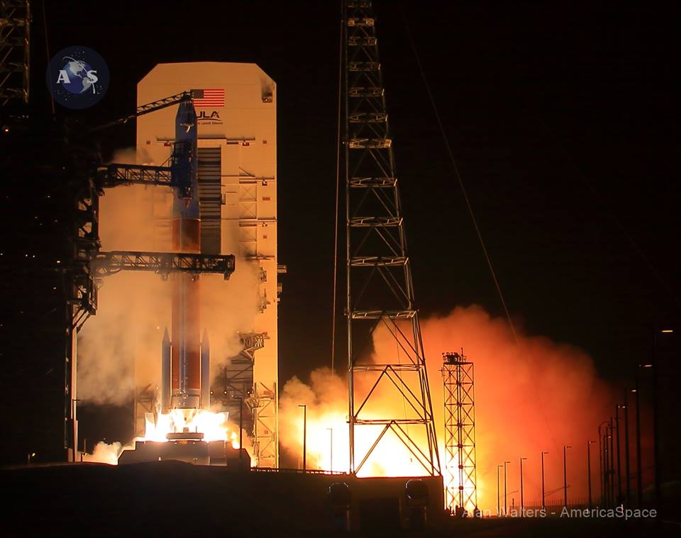
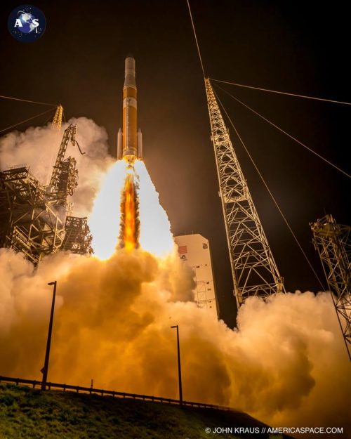
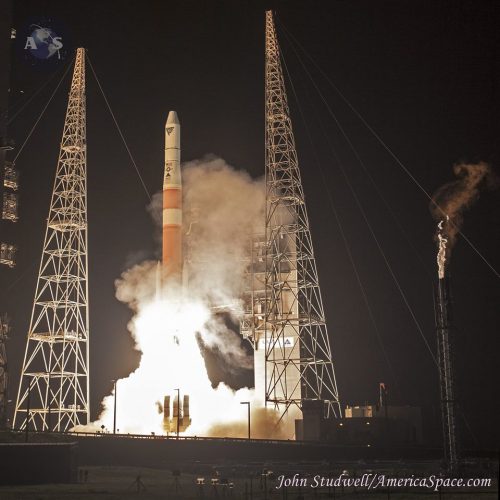
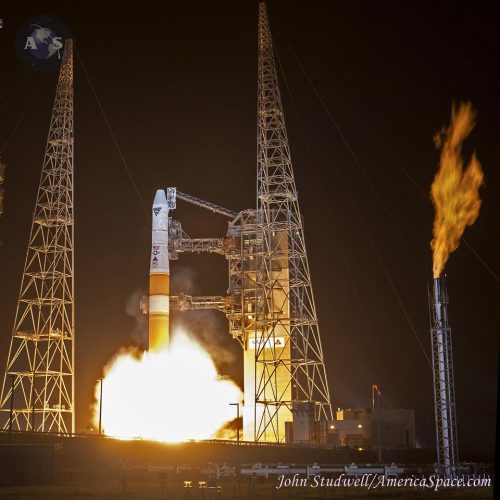
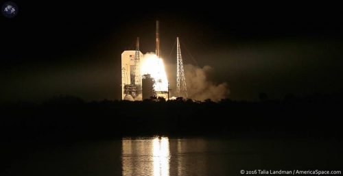
The successful launch Aug. 19, 2016, of two new U.S. Air Force Geosynchronous Space Situational Awareness Program (GSSAP) spacecraft on a United Launch Alliance (ULA) Delta IV rocket joins two sister satellites in forming an extraordinary new U. S. space defense foundation in geosynchronous orbit.
The new ability to inspect disabled U.S. satellites and deter critical U.S. and allied geosynchronous satellites from Russian and Chinese interference and outright attack removes from Russia and China the ability to blind and deafen the U.S. by the stealthy physical take-down of vital missile warning, eavesdropping, and communications spacecraft while staging ground and naval attacks.
One of the two earlier GSSAP spacecraft launched in mid-2014 has already been used to provide detailed imagery of the ailing MUOS 5 military satcom to give the Pentagon unspecified clues about salvaging that mission.
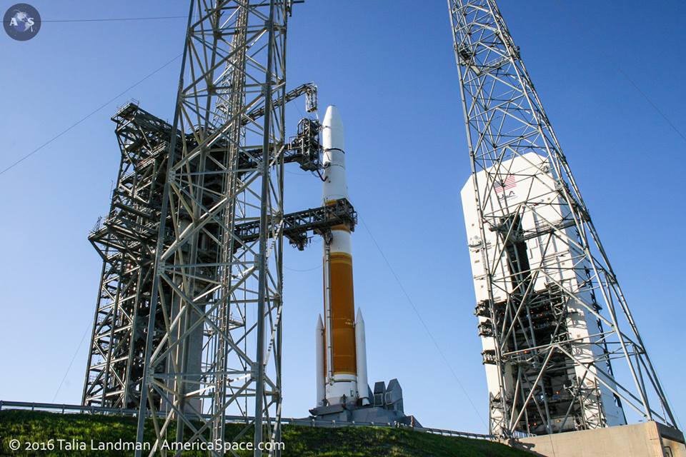
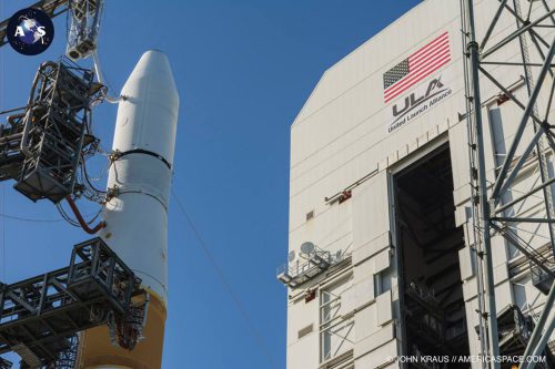
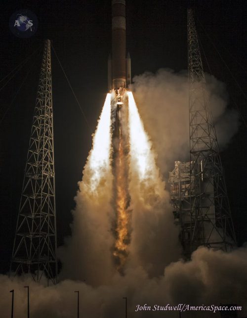
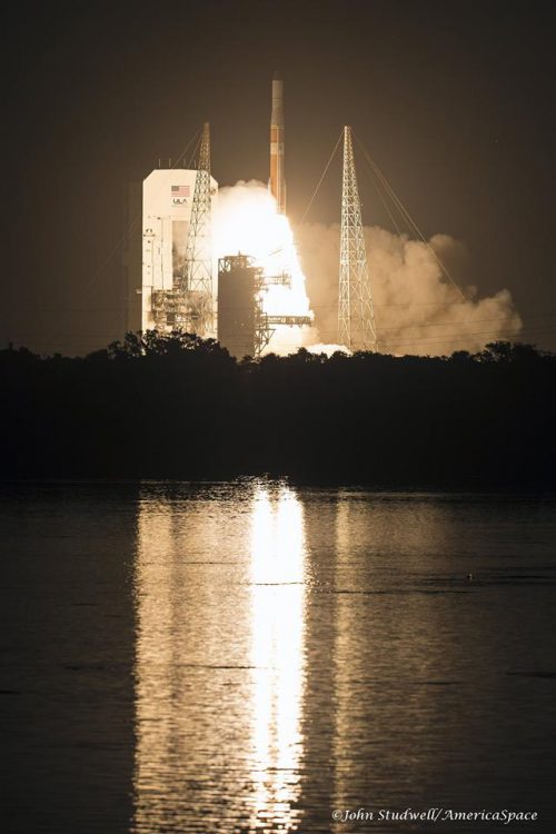
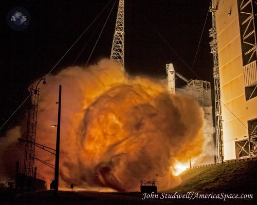
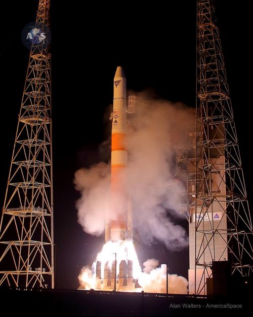
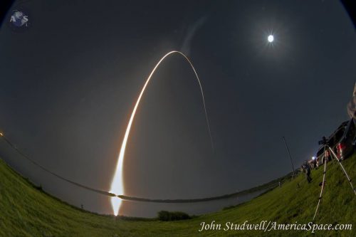
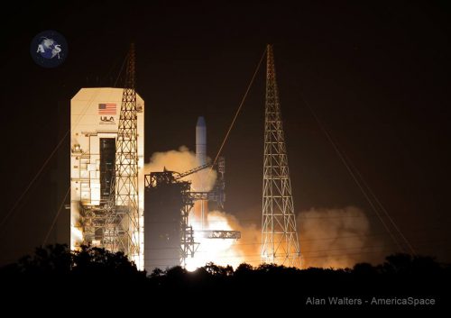
Liftoff of the GSSAP 206-foot-tall, 1.1 million lb-thrust ULA Delta IV, with two solid boosters attached, came at 12:52 a.m. EDT at the opening of a 60-minute launch window. The Air Force adjusted the window to five minutes later on Aug. 18.
According to GlobalSecurity.org the GSSAP satellites are part of the U.S.’s future Space Based Space Surveillance (SBSS) system that will be formed by a whole constellation of satellites and ground facilities to enable the U.S. to image and track other satellites in geosynchronous orbit.
A classified multi-burn profile by the second stage deposited the twin GSSAP 3 and 4 spacecraft in geosynchronous orbit, where they were released about six hours into the flight.
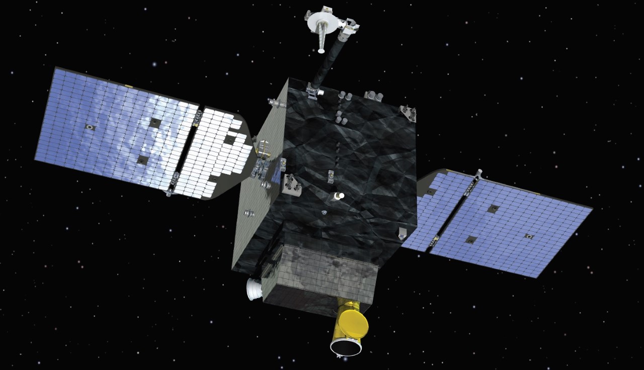
The initial element of that foundation in low-Earth orbit is the Boeing Space Based Space Surveillance (SBSS-1) satellite launched in 2010. It carries a distinctive imaging turret atop its bus, a design that may also have been adopted for the GSSAP spacecraft.
Last night’s mission is designated Air Force Space Command (AFSPC-6).
The oxygen/hydrogen Rocketdyne Aerojet RS-68A power plant for the first stage generated 702,000 lbs of liftoff thrust, while each Orbital ATK GEM 60 solid rocket booster generated 197,500 lbs thrust.
The twin Orbital ATK-built Air Force Space Command satellites will join two others launched on July 28, 2014.
Mounted side by side under the two halves of the 13-foot-wide, nearly 40-foot-long launch shroud, the AFSC-6 satellites were boosted directly into geosynchronous orbit. They remained attached to the Delta IV’s 25,000 lb-thrust Aerojet Rocketdyne RL10B-2 cryogenic upper stage until they reached about 22,300 miles altitude. The satellites are designed to have a four- to seven-year lifetime.
The two new Orbital ATK GSSA-3 and 4 spacecraft will join GSSA-1 and GSSA-2 to drift above and below the geosynchronous arc at about 22,300 miles altitude, where they can image and eavesdrop on primarily Chinese and Russian spacecraft. The new satellites are capable of proximity operations where, with great care, they fly around individual Russian and Chinese satellites and even U.S. satellites in need of inspection.
Analysts say that there are currently about 600 satellites in geosynchronous orbit including operational and backup missions as well as expired spacecraft. GSSAP controllers at the 50th Space Wing, Schriever AFB, Colo., and the Intelligence Community as a whole want to look at them all to understand if there are any collision threats posed by these spacecraft as they move about in an assigned box about 50 miles on a side.
GASSP operates in a team effort “with ground-based telescopes and radars to keep track of space objects and identify potential threats to U.S. satellites,” the Air Force said.
According to Spaceflight101.com, “The project was developed covertly and the identity of the satellites was a secret until the program was declassified in early 2014.”
The first two satellites launched were to undergo a year of testing, but were pressed into service early. This secret mission was necessary to image the MUOS-5 that was stranded just below its geosynchronous orbit position due to a failure in its propulsion system.
Air Force General John Hyten, Commander of Space Command, told an Air Force Association meeting recently that when pressed into service early, the satellites “performed remarkably well.”
“The [MUOS 5] users that requested the information are extremely pleased with the pictures we gave them,” Hyten said. “The pictures are truly eye watering,” he said afterwards at the press conference. “It’s amazing, you don’t often get to see satellites flying in space,” he said.
He said the GSSAP-1 satellite has been drifting at a velocity of one-half to a full degree per day while GSSAP-2 has flown more slowly at one-fourth to one-third of a degree per day occasionally pausing its motions for observations at a single location.
Each GSSAP was developed from the Orbital ATK GEOStar-1 bus that weighs 1,102 lbs with the capability to carry an additional 330 lb-sensor payload including high resolution imaging sensors and possibly top-secret eavesdropping electronics. This means that each spacecraft with the bus and payload combined weighs about 1,430 lbs.
These are extremely high performance satellites with large propellant tanks giving each satellite 3,281 fps of maneuvering capability.
Space Situational Awareness
According to a recent report by Gene McCall of the Georgia Institute of Technology and John H. Darrah, University of Nevada, in their assessment of the Space Situational Awareness: “Although the term space situational awareness is a rather clumsy grammatical construct, space situational awareness (SSA) is a necessity for any nation that seriously bases its military and economic well-being even partly on space capabilities. SSA is the enabling of a description of the location and operation of U.S. space assets as well as the location and function of the assets of other nations, particularly those that are, or could become, our enemies. SSA also identifies the capabilities needed for protecting U.S. assets and for destroying or disabling those of the enemy. Frequently, a mission defeat can be just as useful as destruction while not violating treaties or providing grounds for retaliation.
“We can most likely obtain direct information about the structure and function of a satellite of interest by placing a sensor satellite in close proximity. The latter can take surface photographs of the target vehicle, monitor attitude and orbit changes, and observe its emissions, which may include radio frequency power, optical energy from far infrared to x-rays; and neutrons, protons, electrons, and other atomic and subatomic particles. In general, atmospheric attenuation prevents the observation of particle emissions from the ground unless they are very intense. One could even imagine placing two satellites on opposite sides of the target vehicle, one of them emitting x-rays or neutral or charged particles that could penetrate the structure of the vehicle and the other imaging those x-rays to form a photograph of the target’s interior. We could utilize microwave imaging as well, taking care to prevent damage to the target satellite.
“Provocative? Perhaps. But there appears to be no territorial limiting distance associated with space objects. We can identify them as valuable property, though, and make a case for compensating the owner for any damage done by a sensor satellite. Such an expenditure would be a small price to pay for detailed information about an adversary’s intentions in space. Furthermore, for example, if the satellite contained a weapon of mass destruction (e.g. a nuclear device), we could employ active methods to destroy it. For chemical or biological weapons, the sensor satellite could obtain a swab from the surface of the target, analyze it on board, or return to Earth – as was the procedure with early imaging film canisters. Expensive? Yes, but giving our enemies the upper hand in space would prove even more costly.”
Communication Monitoring
Important factors in SSA are communication capabilities and operations. Each satellite should have a report on its communication history regardless of how little information is available. McCall and Darrah go on to say in that same report: “Basic questions to answer are as follows: Does the satellite emit energy that appears to come from a communication system? How often does it emit such energy? With whom does it appear to communicate? What or where is the source? Does the satellite appear to receive as well as transmit? Does satellite status change following a communication session? Can the nature or details of the communication be determined? Other questions may be appropriate as well, but communication status remains a valuable source of information about the purpose and function of a satellite. Much of this data can be obtained from ground or airborne sensors, but the latter cannot compete in either detail or accuracy with satellites deployed in the same or a nearby orbit in close proximity to the vehicle under study.
“Assuredly, the Air Force and its contractors well understand that the GSSAP vehicles must possess unprecedented accuracy in terms of propulsion and positioning. A collision will result in significant political and financial problems; more- over, it could produce debris capable of contaminating a large portion of the geosynchronous orbit. Certainly, maneuvering operations will generate very tense times at the satellite control center at Schriever AFB, Colorado. The more sparsely populated orbits will demand new technologies and methods.”
McCall and Darrah stated that no matter the difficulties involved, maintaining Space Situational Awareness is a historic moment in U.S. military space operations.
In the words of President Thomas Jefferson, “Eternal vigilance is the price of liberty.”
.
Be sure to “Like” AmericaSpace on Facebook and follow us on Twitter: @AmericaSpace


Thank you Craig Covault for another very informative article! I’ve been enjoying your articles for many decades.
“In general, atmospheric attenuation prevents the observation of particle emissions from the ground unless they are very intense. One could even imagine placing two satellites on opposite sides of the target vehicle, one of them emitting x-rays or neutral or charged particles that could penetrate the structure of the vehicle and the other imaging those x-rays to form a photograph of the target’s interior.”
Hmmmm, this “emitting x-rays or neutral or charged particles that could penetrate the structure” might be quite a bit more difficult if the “structure”, and its “interior” equipment, is buried deeply under lots of regolith or two meters of iron or aluminum radiation shielding on the Moon.
Yep, the Moon has lots and lots of iron, aluminum, regolith, water, carbon dioxide, ammonia, and various other quite useful resources.
And of course historic and mining sites on the Moon require foreign visitors to maintain a respectful and safe distance.
Lunar metals will eventually be used to build many extremely large antenna arrays that can be used for scientific research.
Large optical telescope arrays can also be built out of Lunar materials and electronically linked together to enable the observation of planets orbiting distant stars.
Yep, Lunar ISRU opportunities could significantly reduce the risks and costs of Cislunar transportation and enable us to do many more useful and interesting things on the Moon then compared to what is currently affordable and doable in Earth orbit.
“China is considering launching a permanently manned radar station on the moon, according to reports.
China’s National Natural Science Foundation is funding the 16 million yuan ($2.4 million) feasibility study, which could involve a 50-meter-high radar capable of monitoring larger sections of Earth than current satellites.”
From: ‘China Plans Permanent Manned Moon Base’ By Anthony Cuthbertson On 8/23/16′
At: http://europe.newsweek.com/china-moon-base-lunar-station-antenna-communication-military-spy-492661?utm_source=yahoo&utm_medium=yahoo_news&utm_campaign=rss&utm_content=/rss/yahoous/news&yptr=yahoo