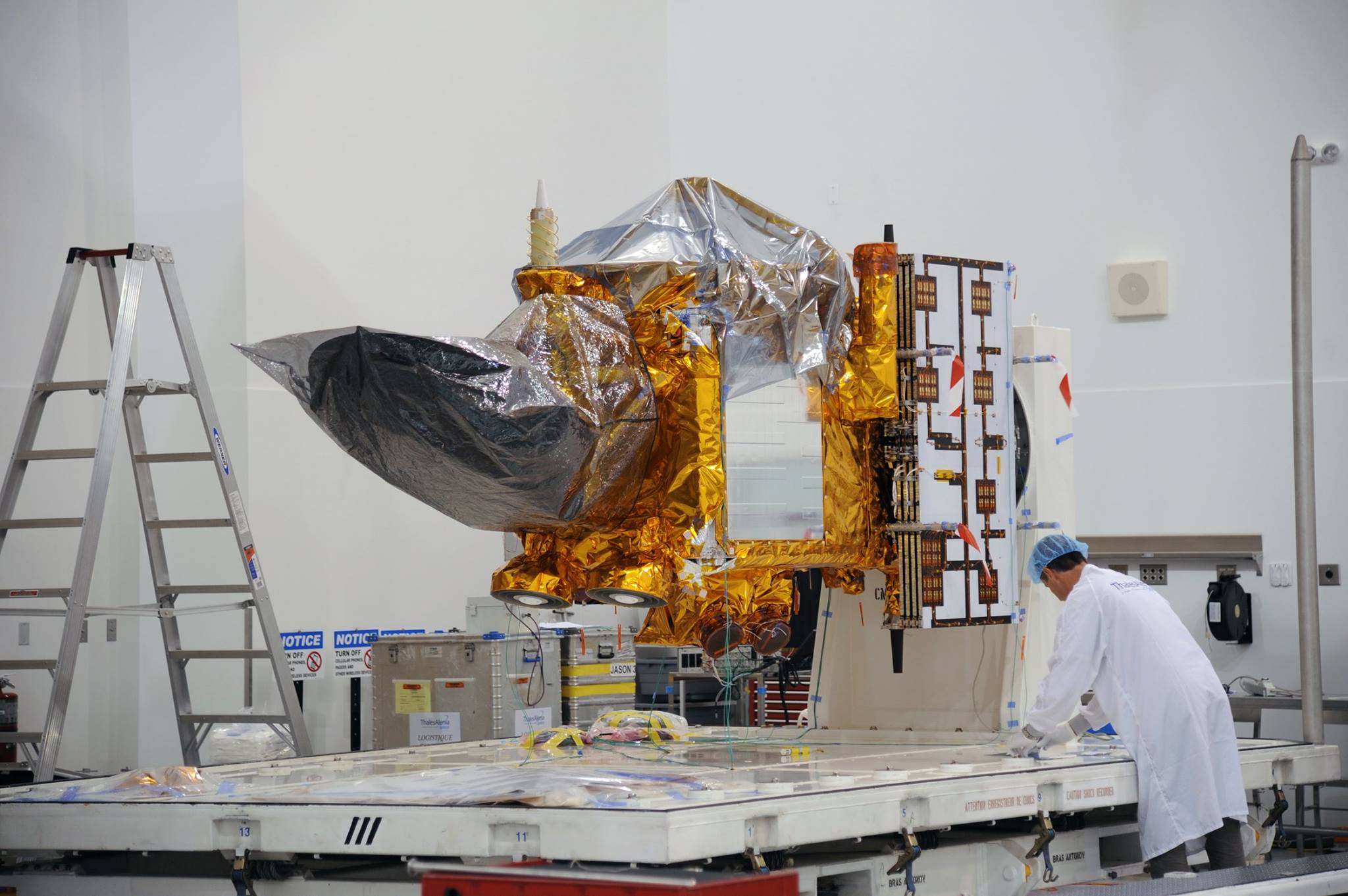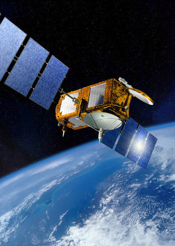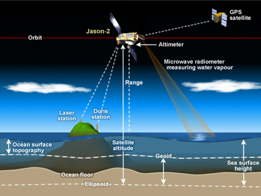
On January 17, an Earth science spacecraft designed to measure the surface topography of our planet’s ocean is scheduled to launch from Vandenberg Air Force Base, Space Complex 4 East. Aboard the craft, a highly accurate radar altimeter capable of measuring the ocean’s surface elevation in any given spot to within 3 centimeters will monitor changes in Earth’s sea level. Jason-3 will be the fourth instrument in an uninterrupted, 23-year study of our ocean’s wave motion, currents and rising waters.
Riding atop a SpaceX Falcon-9 v1.1 rocket, Jason-3 is scheduled to lift-off Sunday morning at 10:42:18 a.m. PST. The spacecraft will be placed in a sun-synchronous low Earth orbit (LEO) operating at an altitude of 1336 kilometers. Once the second stage carrying the Jason-3 satellite separates from its core booster, SpaceX will attempt to match its history making December 22, 2015 powered landing made at Cape Canaveral, this time landing the Falcon-9 core stage on its Pacific based, Autonomous Spaceport Drone Ship, named “Just Read the Instructions.”

The first instrument in the Jason series, TOPEX/Poseidon, took flight in September 1992. Carrying a set of dual radar altimeters, one developed by NASA called TOPEX, the other, Poseidon, by the French space agency CNES, the mission surpassed all expectations. During its long-lived, 13-year operation, TOPEX/Poseidon was hailed as “the most successful ocean experiment of all time.” The data it gathered became the basis for more than 2100 publications, providing new insight into climate research. Hurricane forecasts, El Niño/La Niña prediction, monitoring the health of coral reefs and fisheries, more efficient ship routing and improved management of offshore industries were some the many benefits derived from the mission.
With the success of TOPEX/Poseidon, Jason-1 and 2, Jason-3 will continue to provide an unbroken data stream mapping the steadily rising sea level and surface movement of Earth’s ocean every ten days. The project continues as a global partnership between NOAA, NASA, the French space agency CNES, and the European meteorological agency EUMETSAT.
This unique, long-running and continuous record of sea level rise, wave height, movement, and the direction and strength of surface currents has become one of our most valuable tools in studying Earth’s changing climate. Commercial shipping has relied on data from altimeters like Jason for more than two decades to save fuel and plot efficient courses for its vessels. Data from Jason-2, in operation since 2008, are providing insight into predicting the El Nino weather patterns now affecting the United States, including record flooding and off-season tornadoes in the Midwest.
To better understand the Jason 3 mission and the knowledge gained during the first 23 years of the Jason project, we spoke with NASA/JPL Jason-3 Project Scientist and Oceanographer, Josh Willis. Some of the topics we discussed include:
- Sea level rise is caused by glacial melt, ice sheet melt and thermal expansion.
• Change in sea level is a direct indicator of climate change.
• The rise in sea level is increasing at an accelerated pace.
• The ocean is the most active and efficient heat sink of the planet.
• Thermal gathering properties of the ocean intensify as the carbon saturation increases.
• The tilt in ocean heights monitored by Jason 3 indicate surface current, the data used by commercial shipping to plot efficient courses and save fuel.
• The Jason spacecraft work in conjunction with other LEO observatories such as Aqua and Grace, as well as the ARGO system of autonomous submersibles (i.e. Jason and the Argonauts, from which Jason took its name).
• The Jason-3 launch vehicle, a SpaceX “Full Thrust” core booster, will attempt a historic powered landing on an autonomous barge off the coast of Vandenberg. The name of the robotic vessel: “Just Read the Instructions.”
• Jason-3 will complete a global measurement cycle every ten days.
• Jason-3 will work in tandem with Jason-2
• Following Jason-3, a pair of spacecraft in the series, to be called Jason-CS, are now in the planning stage.

Q: Joshua, thanks so much for taking the time to speak with us today about Jason-3, its goals and history. Can you tell us something of the nature of the Jason series of instruments and if any new technology is incorporated within the Jason-3 instrument?
- A: By and large, Jason-3 is a carbon copy of Jason-1 and 2. There were some developments along the way, but for the most part, these missions are consistent throughout, and very similar to TOPEX/Poseidon. Of course, we always want our measurements to be as accurate as possible, to provide better information about the climate. With the Jason missions, what’s most important is to provide a consistent story. What we really have here is a powerful record that goes back 23-years. Once Jason-3 launches, it will span four different missions. Because we’ve been very careful about how we maintain a consistent set of observations, using consistent technologies as we go along, we have an unbroken record of sea-level change, which is one of the most important tools for understanding climate change in any scientific field. When you’re doing climate science, consistency becomes almost a higher priority than the new innovations. What really matters for understanding climate change is not so much what the ocean sea level is today, but what it is today relative to what it was twenty years ago. We must have these long-term and consistent measurements if we want to accurately predict climate change. That’s what the Jason series of missions does better that any other set of missions that I’m aware of.
Q: So the core value that the Jason mission brings is a better understanding of climate change through monitoring the rise of the sea level?
- A: And a longer record of it. Essentially, each decade brings a new climate on the planet Earth. We have to continue to measure them and do it consistently to understand how our planet is changing.
Q: From an economic point of view, what are the some of the benefits to be gained from the Jason study, both in terms of societal value and as a return on investment
- A: NOAA and EUMETSAT fund Jason-3 with contributions from NASA and CNES. It’s arranged a little bit differently than the previous missions. But, in answer to your question, there are a number of ways that the mission provides economic return. Operational applications for shipping through the monitoring of ocean currents contribute to huge savings in the use of fuel. Also, the containment of oil spills like the Deep Water Horizon event in the Gulf of Mexico is greatly improved through satellite observation and the tracking of current movement through the altimeter data provided by the Jason program.
- The Navy is a very strong proponent of satellite altimetry because it tells you something about currents at the surface with accuracy, providing coverage that you simply can’t get any other way. So the Jason missions provide a very unique and powerful tool for doing oceanography.
- We pretty much know that sea-level rise is going to continue as we move further into the 21st century. We’re also almost certain that it will accelerate during that time. Our most powerful tool for measuring that is the satellite altimeter. The other thing about sea-level rise is, on the time scale of people alive today, it’s essentially irreversible.
- It’s highly unlikely that global sea levels will fall during the lifetime of any people alive today, or their children or their grandchildren. So, it’s really a yardstick to measure how much humans have changed the climate. I think that has a lot of intrinsic value, but like many things related to climate change, it’s difficult to put a dollar amount on it.

Q: Is the Jason mission working in conjunction with other observatories? Are other missions providing data sets that factor into the understanding of Jason’s findings?
- A: Absolutely. People use the altimeter data for many things like monitoring lakes and rivers, flood prediction, counting icebergs, all kinds of things. But one of the major synergistic systems that we haven’t talked about is ARGO. ARGO isn’t a satellite observing system, but rather a system of floats; they’re kind of like the ocean’s weather balloons. They’re autonomous platforms, about three thousand of them throughout the global ocean. They drift, deep at about a thousand meters depth.
- Once every ten days, they dive deep to two thousand meters depth, and then surface and measure a temperature and salinity profile. When they get to the surface, they send this information back via satellite.
Q: So, these floats are truly autonomous?
- A: Yes they are. I fact, there used to be an “autonomous” in the acronym. It actually was named ARGO with the thought of it being synergistic with the Jason mission – Jason and the Argonauts – really because it provides a look below the surface. One thing the altimeter does, it gives us a very powerful piece of information at the surface. But things like the overturning circulation of the ocean, you really need to know the temperature and salinity of the ocean at depth. That’s where the ARGO floats become incredibly powerful tools. When you couple them with the altimeter data, they really tell you a whole lot about the circulation of the ocean all around the planet.
- If you go to the ARGO website, every day the University of California, San Diego updates the positions of all of the ARGO floats in the world. They really cover the planet very comprehensively. It’s an amazing system.
Q: If you were to sum up the mission objective of Jason-3 how would you put it?
- A: To monitor our changing climate and the impact humanity has on the ocean.
Q: How does the use of a radar altimeter in low Earth orbit demonstrate human impact on the ocean environment?
- A: The primary way is through sea level rise. So we’re monitoring sea level rise as the planet heats up. Over the 23 years that the Jason program has been gathering ocean data, sea level has gone up by over six centimeters. If you look at the global average signal, that six centimeters rise is by far the largest clear signal in the data. So, you can see other things like a small drop in sea level during a strong La Niña event. But really the most striking, the largest signal in the 23 years of study is documented to be human-caused sea level rise.
In part 2 of our story, we’ll pick up the conversation after the launch of Jason-3.
Bookmark our Jason-3 Mission Tracker for regular daily updates and LIVE COVERAGE on launch day!
.
Be sure to “Like” AmericaSpace on Facebook and follow us on Twitter: @AmericaSpace
.
Missions » JASON-3 »


Riding atop the last F9 1.1* This isn’t a FT vehicle.
Fixed, not sure how that happened. Thx..
Right. Jason-3 is riding atop an “optimized, Full Thrust, Falcon-9 core-stage rocket, also known as “v1.2”
Today, Sunday, January 17, 2016, this writer had the opportunity to attend the launch of Jason-3 from the NASA viewing location on Vandenberg Air Force Base, in Central California. After speaking with an official at the launch event, I conclude with Ben Evans. Good research Ben, you got it right! Jason-3 successfully blasted into space riding atop a Falcon-9 v1.1 vehicle, the last of its kind to fly. Sunday’s successful Jason-3 core stage and second stage boosters, originally scheduled to fly in August of 2015, had been thoroughly surveyed, inspected and held within their Vandenberg launch facility in preparation for today’s launch.