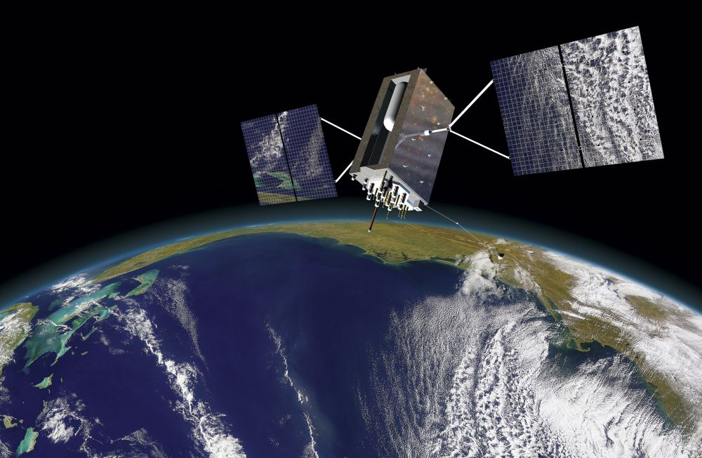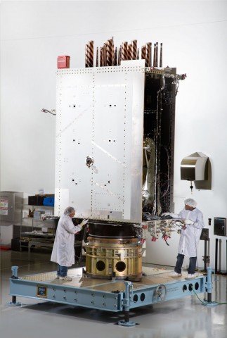
The development of the most advanced Global Positioning System (GPS) satellite ever built reached an important milestone within the last month. Lockheed Martin announced that the system module of its first next-generation GPS III satellite (Space Vehicle One, or SV 01) was lowered over its propulsion core in April, fully integrating the satellite at the company’s manufacturing facility near Denver, Colo. The system module contains the satellite’s essential navigation payload, while the propulsion core will provide maneuverability on orbit. The satellite will be subjected to rigorous testing that simulates conditions in space, bringing it closer to a projected 2017 launch.
Mark Stewart, vice president of Lockheed Martin’s Navigation Systems mission area, discussed the next phase of tests the first GPS III satellite will undergo: “This summer, SV 01 will begin Thermal Vacuum testing, where it will be subjected to simulated harsh space environments. Successful completion of this testing is critical as it will help validate our design and manufacturing processes for all follow-on GPS III satellites,” he related. The United States Air Force intends to purchase up to 32 GPS III satellites.

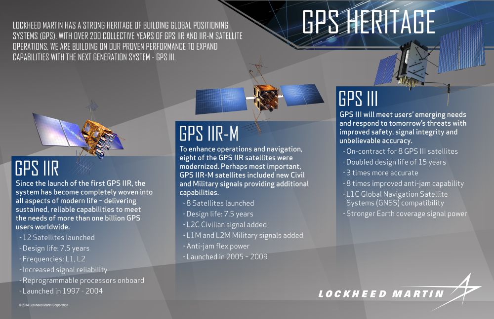
According to Lockheed Martin, the GPS III satellites currently being developed “will deliver three times better accuracy, provide up to eight times improved anti-jamming capabilities, and extend spacecraft life to 15 years, 25 percent longer than the satellites launching today.” The new system will have 500 times the transmitter power of the previous system. In addition, Lockheed stated that the satellite’s L1C civil signal will make it interoperable with international global positioning systems. The company is under contract to build eight of the GPS III satellites at its Denver facility; the Air Force awarded a $1.4 billion contract to Lockheed Martin in May 2008 to develop this new network.
GPS technology has a long heritage extending back to 1973, when the system was first devised by the U.S. Department of Defense in a bid to improve navigation. Rockwell International was the first company contracted to develop this navigation system; its first Block I satellite, GPS-1 (also known variously as Navstar-1 for “Navigation System Using Time and Ranging,” and the Navigation Development Satellite, or NDS) was launched more than 37 years ago aboard an Atlas F booster from Vandenberg Air Force Base in California. It remained operational until 1985. Ten more of the Block I satellites were launched between February 1978 and October 1985 from Vandenberg, with the last satellite in this series being operational through November 1995.
Rockwell also was contracted to develop the Block II GPS satellites, which provided improved capabilities from the previous design (four days of continuous operation without any contact from the Ground Control Segment, Ultra-High-Frequency cross-communications linkage between each spacecraft, and nuclear-detonation detection sensors). Nine of the Block II satellites were launched between February 1989 and October 1990 from Cape Canaveral Air Force Station (CCAFS), with the last satellite in this series staying operational until March 2007. Rockwell also developed a Block IIA series that launched from CCAFS from November 1990 to November 1997; these provided an expanded 180-day capacity for continuous operation without contact from the Ground Control Segment.
In 1989, General Electric Astrospace (later Martin Marietta and Lockheed Missiles & Space, and today’s Lockheed Martin) was contracted to develop the Block IIR “Replenishment” series. The first satellite in this series was lost in January 1997 during a spectacular launch failure at CCAFS, when its Delta II launch vehicle exploded just moments after liftoff due to a cracked solid rocket motor.
However, on a positive note, another satellite in the series was successfully launched that July, and is still operational nearly 18 years later. Another 12 Block IIR satellites were launched by November 2004. In addition, eight Block IIRM satellites were launched between September 2005 and August 2009.

The current network is upheld by Boeing’s Block IIF satellites, which will keep the Navstar system afloat through 2017, when the first GPS III satellite should be ready to launch. This system was intended to consist of 33 satellites, but was pared down to 12 in 2001; the first satellite in this series was launched after several delays in May 2010. The Block IIF satellites do not require an apogee motor, as they are inserted directly into their operational orbits. The nine that were launched between May 2010 and March of this year operate at semi-synchronous medium Earth orbits (MEO) at an altitude of 12,710 miles (20,460 km), circling the planet every 12 hours. They each have a 12-year intended service life.
The addition of the next-generation, advanced GPS III satellites to the Navstar system ensures that navigational capabilities will be improved for both military and civilian uses in years to come.
Many thanks to Ben Evans for assisting with this article.
Be sure to “Like” AmericaSpace on Facebook and follow us on Twitter: @AmericaSpace
.
Missions » GPS » Missions » GPS » GPS 3 »


One Comment
One Ping
Pingback:Air Force Certifies SpaceX to Fly National Security Missions, Ending ULA Monopoly as DOD Launch Provider « AmericaSpace