In a more favorable universe, this month would feature the 50th anniversary of America’s seventh crewed lunar landing. If it had flown, Apollo 18 would have been the beginning of an ambitious sequence of three missions, which would have brought the program to its intended conclusion. In many ways, the Apollo program reached its peak just as it ended. Apollo 17 was the first flight to utilize the hardware to the full extent of its capabilities, setting new records for time spent on the lunar surface, distance travelled, and samples returned. Instead of building on this foundation of experience, President Nixon chose to cancel the final three lunar landings. Today, it is hard not to wonder what the lost Apollo missions would have achieved if they had flown. With archival documents and detailed photography from the Lunar Reconnaissance Orbiter (LRO), it is possible to piece together mission scenarios for Apollos 18, 19, and 20 and visualize the natural wonders which they would have explored.
The costs of Apollos 18, 19, and 20 were minimized by the availability of preexisting hardware. The Saturn V rockets, Command Modules, and Lunar Modules for these missions were contracted and largely complete. Flying these missions was a reasonable proposition, and they likely could have been accomplished without delaying Skylab and the Space Shuttle by more than 1-2 years.
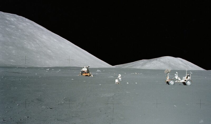
If they had flown, the cancelled lunar landings would likely have resembled the preceding Apollo J-missions. Apollos 15, 16, and 17 each loitered on the lunar surface for three days, and they featured a Lunar Roving Vehicle (LRV) which could venture up to 6.2 miles (10 kilometers) from the landing site. Two of the cancelled flights would have included a professional scientist on the crew to enhance the mission’s science return. Thanks to NASA’s increasing confidence in the Lunar Module, they might have landed in more complex terrain than their predecessors. Further augmentations were unlikely. A small rocket-powered Lunar Flying Unit was studied for two years, but it was understandably shelved due to safety concerns. Geologist-astronaut Jack Schmitt proposed a landing on the far side of the Moon. However, his proposal required two communications satellites, which would not fit within NASA’s constrained budget.
Before we begin reconstructing the cancelled Apollo flights, it is important to note that these mission plans – particularly the landing sites – are not definitive. The Apollo Site Selection Board, a joint panel of scientists and engineers, usually selected a landing site less than a year before the mission itself. For instance, the Apollo 18 site would have been finalized sometime in the fall of 1972. In contrast, Apollo 20 was cancelled in January of 1970, and Apollos 18 and 19 quickly followed in September of the same year. It is also unclear whether three more J-missions were even possible, since one of the remaining Lunar Modules was designed for a shorter H-mission. However, it is still possible to glean some insight into the objectives for the cancelled missions, as some landing sites were notionally manifested in planning documents while others were considered for the missions which did fly.
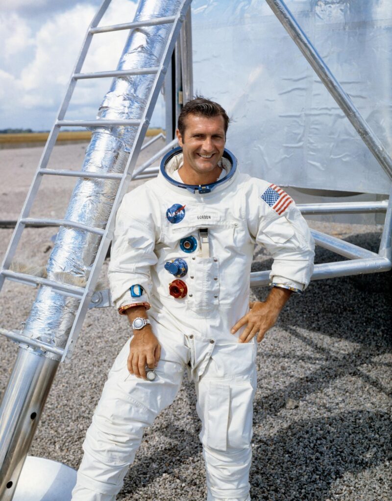
The J-missions were conducted at a cadence of one flight every eight months. Apollo’s apex would have commenced with the launch of Apollo 18 in August of 1973, 50 years ago this month. As AmericaSpace’s Ben Evans described, the mission’s crew complement is relatively certain. Deke Slayton, the Chief of the Astronaut Office, firmly adhered to a three-flight crew rotation, with each backup crew rotating into a prime role three missions later. According to this scheme, Apollo 12 veteran Dick Gordon would have commanded Apollo 18. He would have been joined on the lunar surface by Jack Schmitt. Schmitt eventually became the first and only geologist to walk on the Moon when he was reassigned to Apollo 17 following the cancellation of his original mission. Meanwhile, Vance Brand would have operated a suite of instruments from lunar orbit. Beginning with Apollo 18, the cameras inside the Service Module’s Scientific Instrument Module (SIM) Bay would have been replaced by a suite of spectrometers to map the composition of the lunar surface.
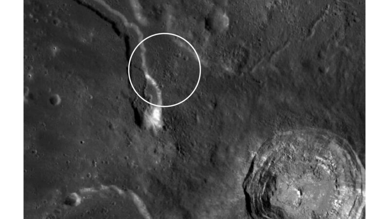
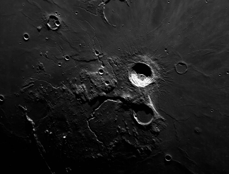
One enticing candidate landing site for Apollo 18 was the Aristarchus Plateau. This massive 120-mile-wide block of crust is elevated a mile above the surrounding plains, and it is perhaps the most diverse region on the Moon. Two weeks after the triumph of Apollo 11, NASA’s Office of Manned Spaceflight released a memo which described the agency’s plans for the subsequent lunar landings [1]. One particularly interesting geological feature on the plateau was notionally identified as the landing site for Apollo 18: Schroter’s Valley.
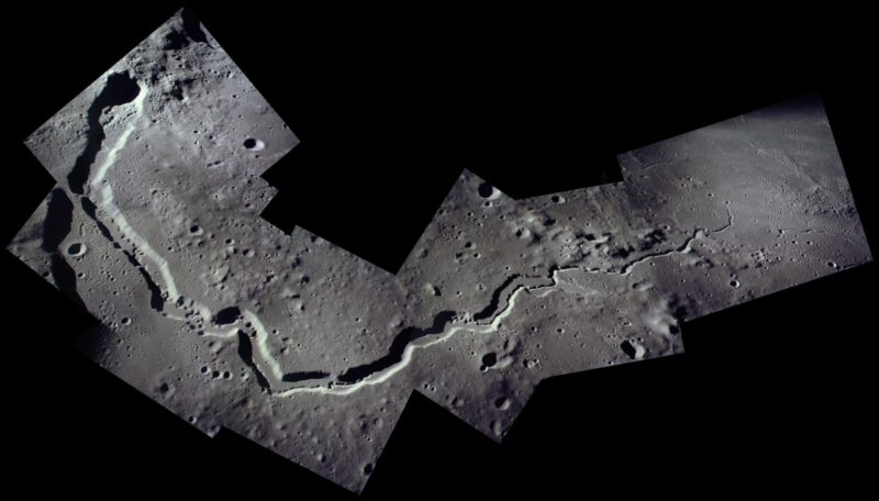
Schroter’s Valley is the longest and deepest of the Moon’s numerous sinuous rilles. Planetary geologists believe that the rilles are former lava tubes whose ceilings have collapsed. While Apollo 15 visited Hadley Rille in 1971, there were still several open questions about these features for Apollo 18 to answer. In particular, lunar scientists hoped to sample exposed bedrock protruding out of the edge of the valley. Intact outcrops of rock are sometimes referred to as the “holy grail” of lunar geology, as most Moon rocks were fractured and pulverized by billions of years of micrometeorite impacts. Dave Scott and Jim Irwin observed lava flows protruding out of Hadley Rille during Apollo 15, but they were unable to sample it due to their constrained timeline. Samples from these layers would shed light on the duration and intensity of a typical lunar volcanic eruption.
The contractor Bellcomm was responsible for analyzing the Apollo landing sites on behalf of NASA [2]. Their engineers concluded that a landing inside the five-kilometer wide canyon of Schroeter’s Valley was unsafe. However, they did identify a safe landing site just 1.2 miles (2 kilometers) to the east of the rille. The terrain surrounding Schroter’s Valley is covered by ejecta from the massive Aristarchus impact basin. It would have been rougher than the prior Apollo landing sites. However, Gordon was regarded as one of the best pilots in the Astronaut Office, and there is little doubt that he could have landed safely on the Aristarchus Plateau.
During their three EVAs, Gordon and Schmitt would have driven up to eight miles along the length of Schroter’s Valley. Even Schmitt, the experienced field geologist, would have been impressed by the canyon. At up to 3,000 feet in depth, it rivals Earth’s Grand Canyon. The valley would have dominated the astronauts’ view, snaking several miles in either direction. As they drove along its vast expanse, Gordon and Schmitt would have searched for a location with shallow slopes and accessible bedrock. They would also have photographed the layers on the opposite wall of the canyon and a second smaller rille which is nested inside its floor. At the southernmost extent of their journey, they would have visited a deep, bulbous feature known as the “Cobra Head.” The lava tube of Schroter’s Valley terminates at this depression, and Apollo scientists suspected that it was a volcanic vent.
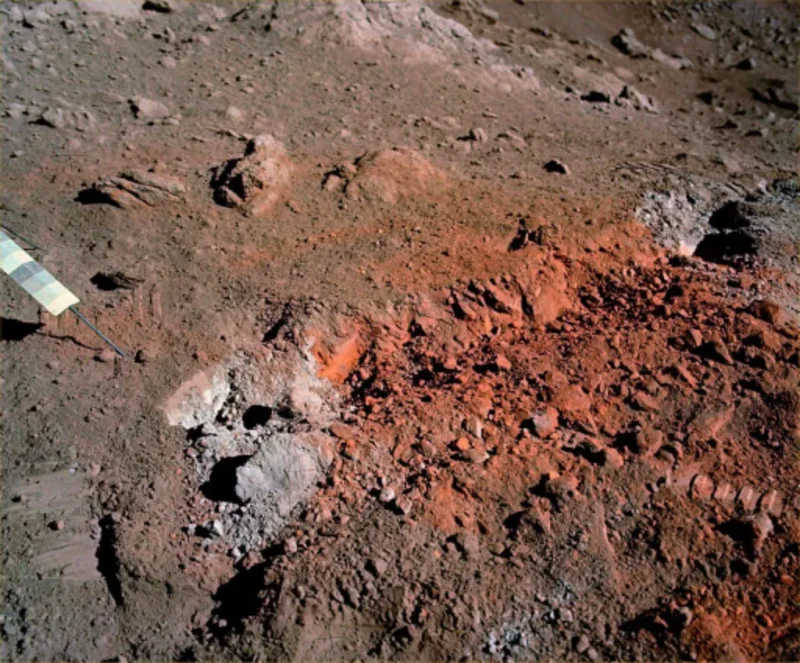
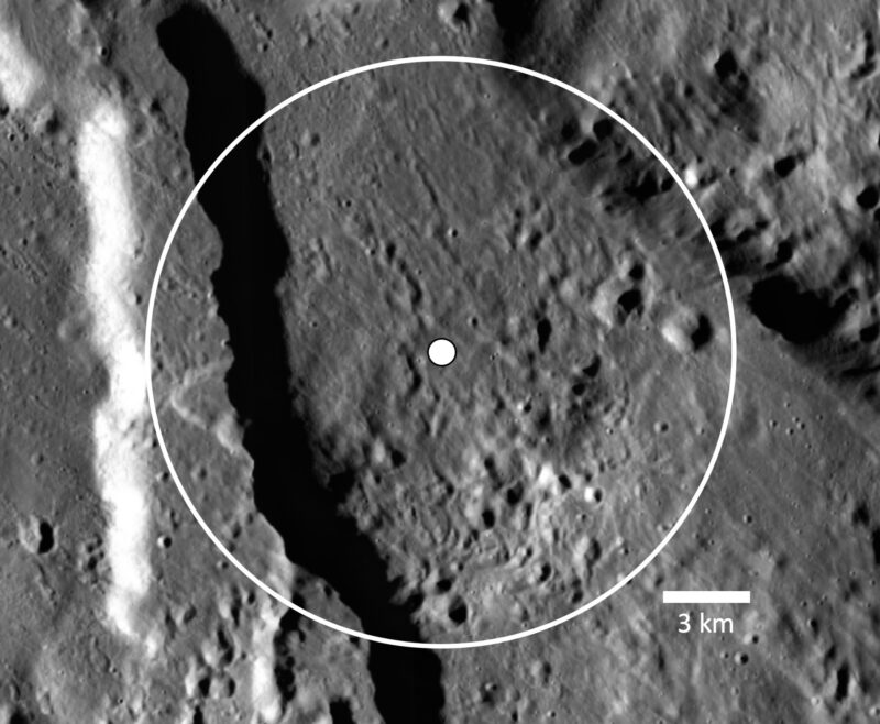
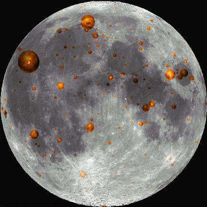
The Apollo 18 crew could also have reached the margin of the elevated central portion of the Aristarchus Plateau. This area is covered in the largest pyroclastic deposit on the Moon. Lunar pyroclastic deposits were created by effusive “fire fountains” of magma, which immediately solidified into small glass beads. The famous orange soil at the Apollo 17 landing site is one example of a pyroclastic deposit, but it is dwarfed by the immensity of the Aristarchus Plateau. Gordon and Schmitt would have been shocked to discover a vast expanse of patches of orange glass stretching into the distance. Their photos would have been a remarkable contrast to the grey Moon which we are familiar with.
Finally, Apollo 18 would have attempted to resolve the mystery of Transient Lunar Phenomena (TLP). Some astronomers, as well as the Apollo 11 crew, occasionally reported an abnormal reddish glow emanating from a handful of sites, including the Aristarchus Plateau. Some lunar scientists believed that TLP were nothing more than an optical illusion, while others theorized that they were indicative of volcanic outgassing from the Moon’s interior. The long-lived Apollo geophysics package included a seismometer and a mass spectrometer capable of detecting any outgassing. A positive result would shatter the precept that the Moon is geologically dead.
The second part of this article will be released in one week. It will describe the proposed Apollo 19 and Apollo 20 missions to the Marius Hills and Copernicus Crater.
Missions » Apollo »

One Comment
One Ping
Pingback:Lost Moon: Reconstructing the Missions of Apollos 18, 19, and 20 (Part 2) - AmericaSpace